Monday, 5 March 2001
 |
 |
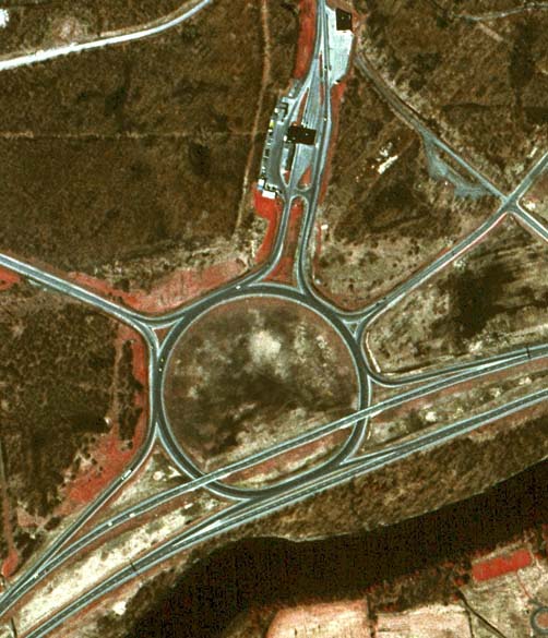
Orientation: NY 37 is the divided highway running diagonally across the bottom. St. Lawrence CR 45 follows the Rooseveltown Access Road, which enters the traffic circle at ten o'clock and leaves it at two o'clock, making a right angle through the intersection at far right. CR 45 provides access to industrial plants on either side of the traffic circle. At top is the approach road and United States Customs plaza for the Seaway International Bridge, which spans the St. Lawrence River to Cornwall, Ontario.
The interchange: The Rooseveltown Traffic Circle is one example of how the basic circle design can be modified to create a true grade-separated interchange. Here, the modifications are quite simple, while still affording efficient high-speed connections for the main route (in this case, NY 37). (For other examples of modified traffic circles, visit Week 5 and Week 6.)
In the eastbound direction on NY 37, the entrance and exit ramps for the traffic circle are moved to a separate collector-distributor roadway, while two lanes for through traffic bypass the circle entirely. On NY 37 westbound, the through lanes pass over the circle itself. The other three approaches intersect the circle in the usual fashion, and it is not difficult to visualize NY 37 doing likewise, as if the bypass lanes had not been constructed.
The modifications in this instance are adequate for the relatively
low-traffic international crossing at Cornwall. A busier crossing would
require more extensive improvements, such as eliminating the left-hand
exits and entrances on the eastbound side of NY 37, and prefarably
providing a more direct connection between NY 37 and the bridge
approach.
 |
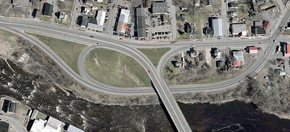
Besides the Rooseveltown Traffic Circle, only two other true
interchanges exist in St. Lawrence County. Above is the junction of NY
37B with Center and Willow Streets in the Village of Massena. NY 37B
enters at left on Center Street, then curves south onto Parker Avenue,
bridging the Grass River at bottom. A continuation of Center Street
comes in from the right and meets NY 37B westbound at the interchange.
Willow Street enters at top right, crossing Center Street and curving
under the Parker Avenue Bridge to join NY 37B's eastbound lanes. The
interchange thus formed resembles a "trumpet" design, but with each
travel direction connecting to a different roadway. A similar example
is found at South Amsterdam.
 |
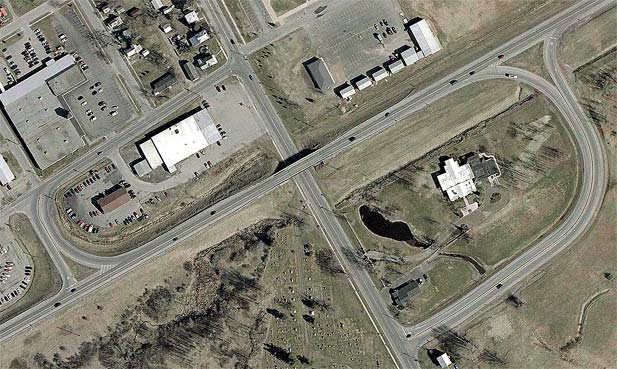
This is the junction of NY 37 and NY 812 on the edge of the City of
Ogdensburg. NY 37 runs diagonally from left to right, while NY 812
enters at bottom and turns east with NY 37 toward the Ogdensburg-Prescott International Bridge.
State Street continues north from NY 812 into the city as reference route 970E. The interchange here is an
old-fashioned folded diamond, where the exit ramps are "flipped" to
from cloverleaf-style loop ramps. In this case, the westbound ramps
also intersect Fine Street, two blocks of which serve to connect the
bypass with State Street (technically, NY 812 southbound follows these
two blocks).