|
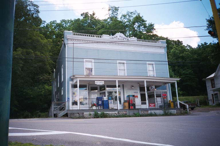
| This is the post office at Middlesex, a hamlet in Yates County at the junction of NY 245 and NY 364. It is also a general store, as is sometimes the case in the small rural towns of Upstate New York. This kind of old storefront, which looks as if it ought to be one of a row of similar structures, is also often found standing alone, looking rather out of place in such a small community. |
|
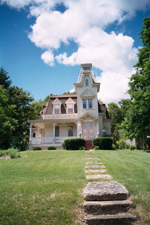
| This used to be a classic haunted house in Naples. Picture it with an overgrown lawn, glass missing from the top window and some of the others slightly open, and plain black and white paint, cracked and peeling. Also picture it with the crescent moon perfectly framed in the upper left corner, and you'll see it as I first did one summer night. Imagine my disappointment when I returned in search of it, and found this! |
|
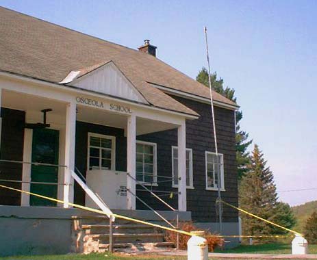
| Could this be one of last one-room schoolhouses in New York State? Probably not, since there seem to be at least a few rooms in this building, and Osceola hasn't got its own school district at any rate. The tiny hamlet of Osceola is about as remote as they come, located in southwestern Lewis County on the edge of the Tug Hill plateau. The town hall and library are housed in a run-down former church nearby. |
|
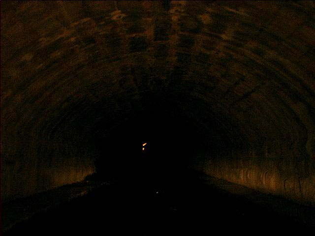
| In Orleans County, the Culvert Road passes beneath the Erie Canal. A nighttime trip through this confined structure is not for the claustrophobic. The vertical clearance is given as 7 feet 6 inches. |
|
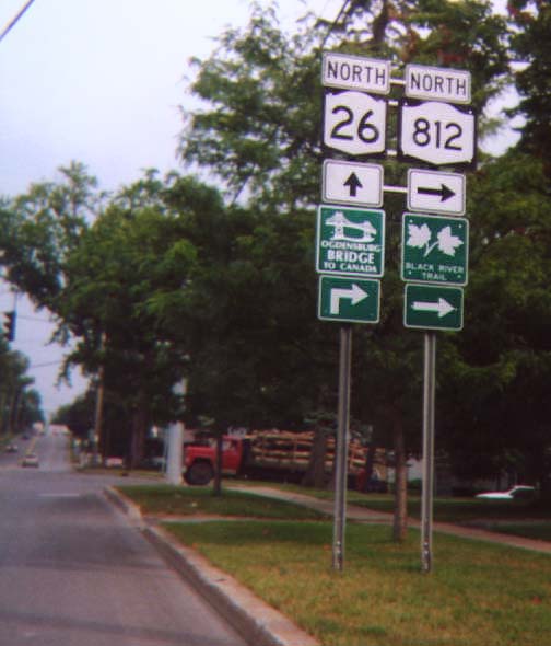
| On this directional assembly in Lowville, Lewis County, trailblazers are posted for the Black River Trail and the Ogdensburg-Prescott International Bridge (shown as "Ogdensburg Bridge to Canada"). The Black River Trail follows NY 46, NY 12 and NY 812 from Rome to Ogdensburg. NY 812 terminates at the international bridge. The arrow placed below the bridge trailblazer on this assembly is incorrect: it should be the same as that used with the NY 812 and Black River Trail markers, rather than the advance turn arrow. |
|
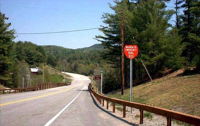
| In Warren County, as in many locations nationwide, the existence of 911 emergency services are announced on highway signs. In this case, the county highway department must have ordered too many Interstate sign blanks and used them for this purpose. (More likely, the shape was chosen for its suggestion of a fire department's shield.) |
|
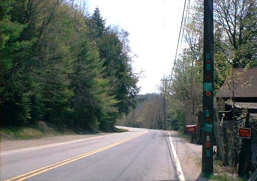
| Two reference markers for NY 28N, along with various other reflective items, have been affixed to this utility pole. However, this road is not NY 28N, but rather a Warren County highway! Either this utility pole was unusually prone to being struck by snowplows, or the nearby homeowner is a collector of reflective roadside paraphernalia. |
|
| In Batavia, this directional assembly reaches literally up into the trees. |
|
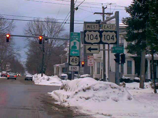
| The most notable feature of this assembly in Oswego is the use of US 104 shields. US 104 has not existed since the early 1970's, when it was redesignated NY 104; only a very few US 104 shields still stand. Also of interest here is the "END NY 48" signage: generally, "END" banners are placed above shields at an assembly in advance of the intersection. Finally, note the City of Oswego's signature large street name sign (in this case, West Bridge Street), the missing arrow for "US" 104 eastbound, and the use of the "graduate" trailblazer for SUNY Oswego. |
|
| A US 15 shield on NY 63 south near its terminus in Wayland. The sign is probably an error since US 15 has not passed through the village for over 25 years. Here and there along NY 15, other reminders of the road's former status can still be found, such as an old shield in downtown Rochester. |
|
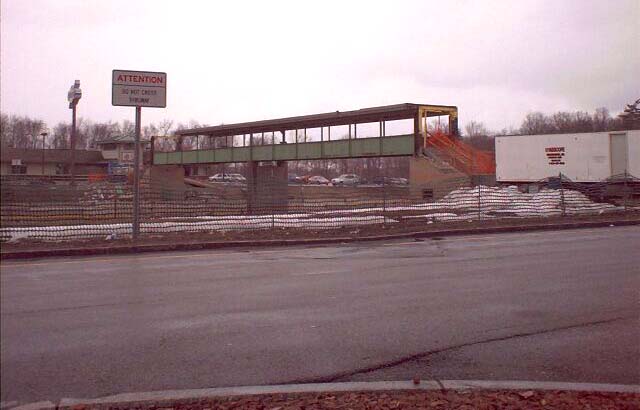
| Until 2001, the New York State Thruway's Iroquois and Indian Castle service areas were connected by a pedestrian bridge. Originally, this was due to the existence of food services on one side only. Today, restaurants are found at all service plazas, and the bridge has become an unnecessary expense. Here it is shown in the process of being dismantled. A new sign informs travellers of their newfound confinement to one side of the highway. |
|
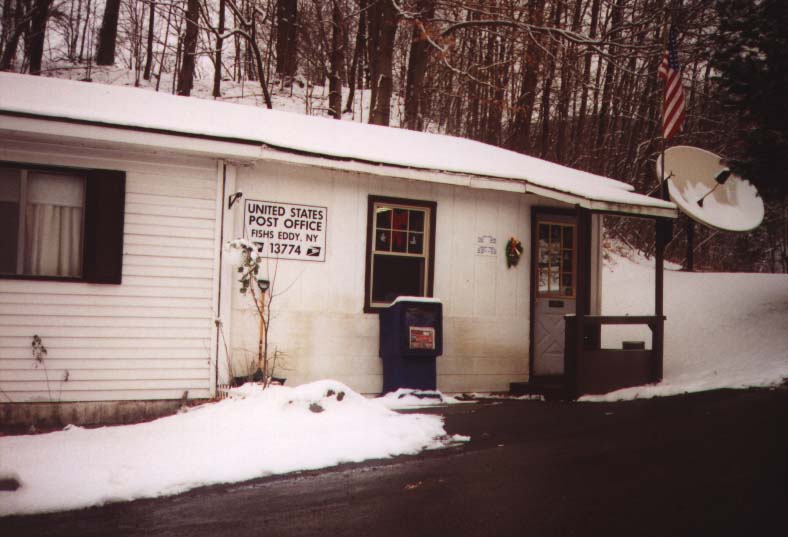
| A small hamlet on the Delaware River bears the unlikely name of Fishs Eddy. This name is shared by a fashionable chain of home decor stores in New York City. It is not entirely clear why this is so. |
|
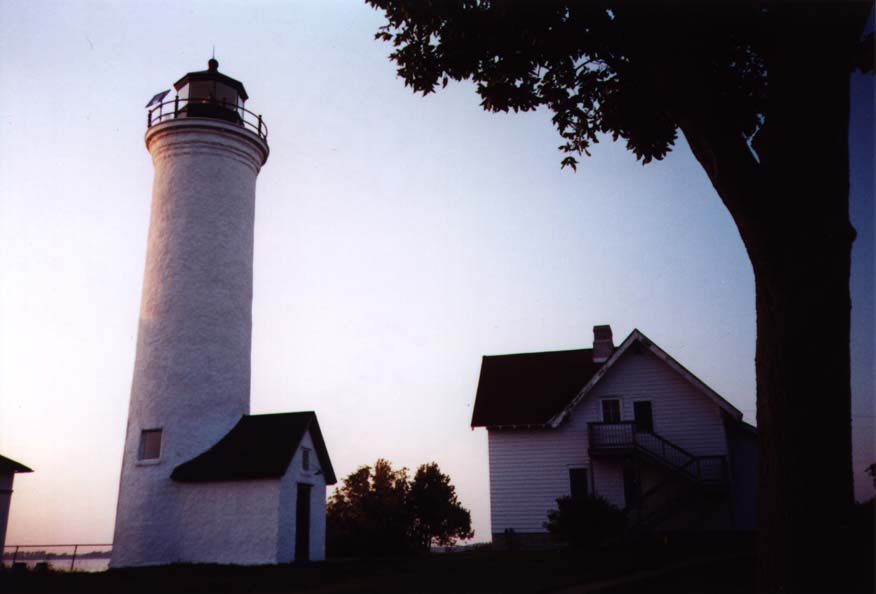
| The picturesque lighthouse at Tibbets Point, at the end of Jefferson CR 6 west of Cape Vincent. The grounds are open to the public, and the keeper's house is now a hostel. The lighthouse marks the southern entrance to the St. Lawrence River from Lake Ontario. |
< Gallery 2 | Gallery
4 >
<< Back