Interchange of the Week
Monday, 24 September 2001
Monday, 24 September 2001
New York State Thruway - Berkshire Section
 |
|
|
|
|
|
|
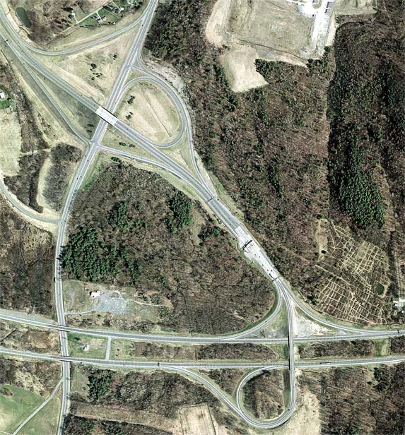
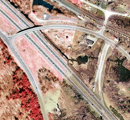
Orientation: The New York State Thruway Berkshire Section runs from left to right at bottom. I-90 enters at top left, then joins the Berkshire Section running toward bottom right. US 9 runs bottom to top at left.
Exit numbers: Exit B1 on the New York State Thruway is for I-90 and US 9 to Albany and Hudson. Exit 12 on I-90 is for US 9 to Hudson.
The interchange: At Exit B1, I-90 leaves the Thruway for a non-tolled freeway through downtown Albany. The I-90 designation rejoins the Thruway mainline at Exit 24. That portion of the Berkshire Section west of Exit B1 carries the reference route 912M designation. Just north of Exit B1, I-90 has in interchange with US 9, consisting of a five-ramp partial cloverleaf favoring the predominant north-to-west movement of traffic.
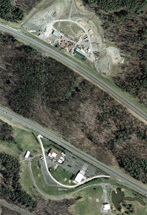
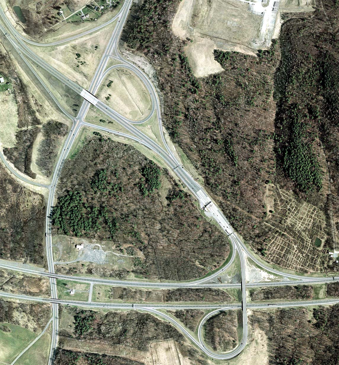
Abandoned service plazas (click
image to enlarge): Just west of Exit
B1 are abandoned service areas on either side of the Berkshire
Section. The Rensselaer Service Area served westbound traffic, and the
Columbia
Service Area served eastbound. They were likely closed due to low
traffic counts, which would have arisen when the I-90 freeway was
completed, diverting much of the Albany-bound traffic. Had the service
plazas been built east of Exit B1, they might still be in operation.
There is now a gap in fuel services for some 70 miles for westbound
traffic between the Massachusetts Turnpike and the Thruway mainline,
and almost 100 miles between restaurants. Today, the Columbia plaza in
particular remains largely intact, and both are now used for other
purposes, the ramps to and from the Thruway having been disconnected.
 |
|
|
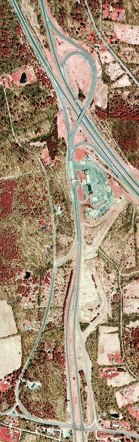
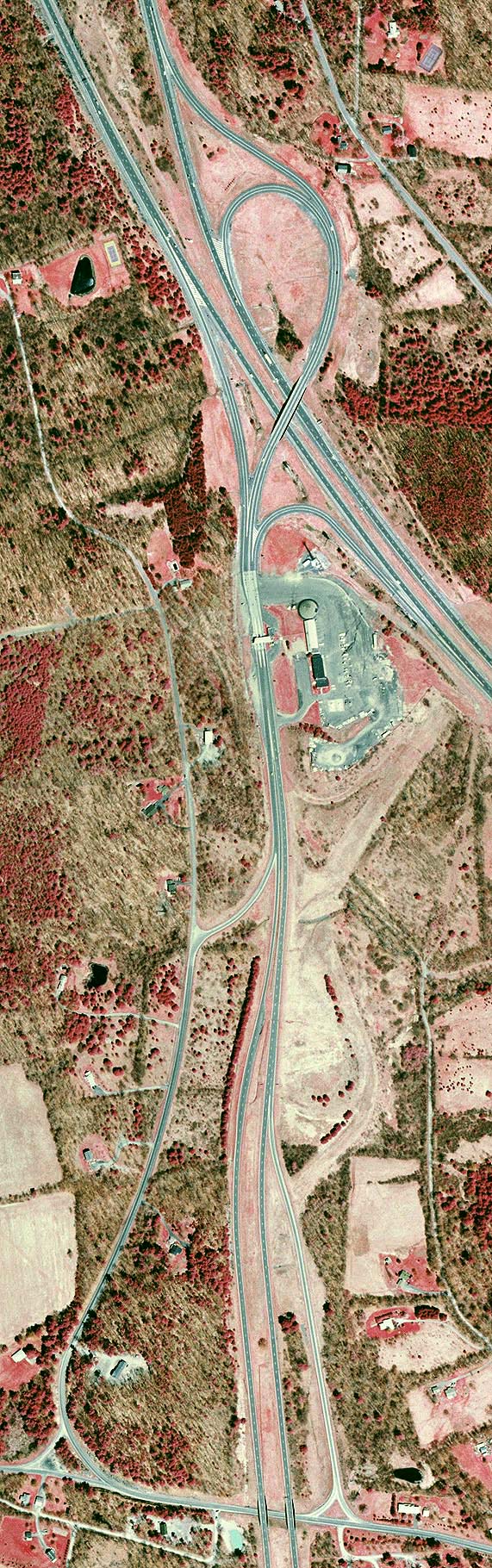
Orientation: The Berkshire Section (I-90) runs from top left to right, and the Taconic State Parkway enters at bottom. Rock City Road runs across the bottom edge. It is county maintained east of the Taconic State Parkway, as are the connecting roads between the two.
Exit numbers: Exit B2 is for the Taconic State Parkway and for NY 295. Exits on the Taconic State Parkway are not numbered.
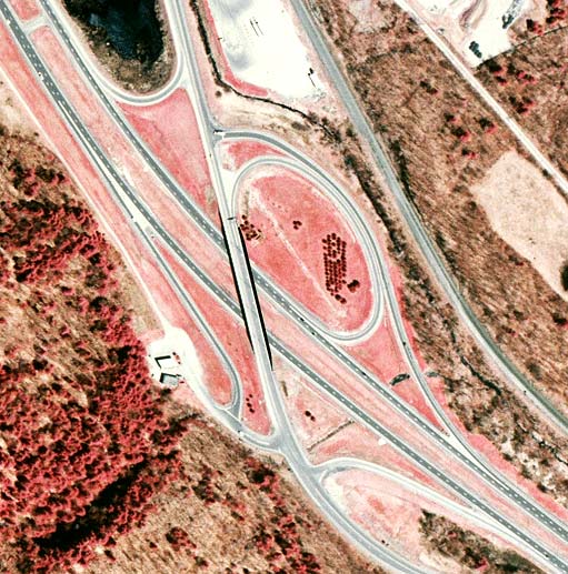
The interchange: The Taconic State Parkway ends at the Berkshire Section, and the "trumpet" design used is typical of such situations. However, this photo shows graded areas for a never-constructed "double trumpet", as the Taconic State Parkway was once intended to continue north to at least US 20. The parkway narrows abruptly at the point where it moves onto what was originally to be the connector between the two "trumpet" interchanges.
The first southward interchange on the Taconic State Parkway is for
NY 295. It does not directly intersect this highway, however, being
instead an enlarged half-diamond with Rock City Road. This road
intersects NY 295 some distance to the east of this photo. Still, this
is an important interchange, as it carries truck traffic between the
Berkshire Section and NY 295, such vehicles being prohibited throughout
the parkway's length. There is also a complete interchange with NY 295
to the south of here.
 |
Orientation: The Berkshire Section runs from top left to bottom right. NY 22 runs from bottom right to top.
Exit numbers: Exit B3 is for NY 22 to Austerlitz and New Lebanon. It also serves Stockbridge and West Stockbridge, Massachusetts, for eastbound traffic.
The interchange: This is the last exit on the Berkshire
Section before entering Massachusetts. The interchange is outside of
the ticket system, as tolls are collected and tickets issued at the
Canaan toll barrier between Exits B2 and B3. Therefore, this
interchange has a much smaller size and is not of the "trumpet"
configuration. It is a five-ramp partial cloverleaf, very similar to
that at Exit 12 on I-90. The eastbound exit ramp
intersects an otherwise little-used dirt road before joining NY 22
itself. The south-to-west entrance ramp is a relatively recent
addition; there had previously been a left turn onto the cloverleaf
loop ramp.
Massachusetts Turnpike (imagery
from NYSGIS and MassGIS): This photo shows the
State Line area,
where the Berkshire Section becomes the Massachusetts Turnpike. Also, reference route 980D stems from NY 22, becoming
MA 102 at the state line. The actual boundary location is to the right
of center, continuing the diagonal of Flint's Crossing Road (top right
corner). Note the pavement change between Thruway and Turnpike
maintenance, actually a short distance inside New York State. Because
the Massachusetts Turnpike predates the Berkshire Section of the
Thruway, it originally came to an end at MA 102 immediately inside
Massachusetts. The old pavement of the Turnpike is clearly visible in
this image as well as on the ground; it is still used as a means of
access for official Turnpike vehicles.