NY 22 Travelogue
(click any image to enlarge)
NY 22 is one of the longest north-south highways in New York, and one of the oldest components of the State's highway system. Running as it does along the eastern edge of the state, its character changes periodically to reflect that of the adjoining states: Connecticut, Massachusetts, Vermont. The journey leads through surroundings of almost every description available in New York: mountain and valley, lake and pasture, small village, middle-sized city, crowded suburbia, even the Metropolis itself.
 |
NY 22 crosses the Bouquet River in the small, picturesque town of Willsboro. |
NY 22 begins inauspiciously amongst drab brick and masonry structures in The Bronx, near the northern limit of the city of New York. It is just another urban street corner where it meets US 1, the Boston Post Road, a stone's throw from Interstate 95. Half a century ago, however, this venerable route escorted the motorist triumphantly into Midtown Manhattan, terminating at Columbus Circle, departure point for many an old-fashioned guidebook motor tour.
Northbound for Canada, we leave behind the Metropolis and enter the city of Mount Vernon. We pass on tree-shaded streets through this old commuter's town, presently entering a string of moderate to upscale residential communities: Bronxville, Tuckahoe, Scarsdale. This last is the most exclusive, with its homes so grand as to be invisible from the road. Their presence is disclosed, however, by an unusual number of shiny, dark-colored, luxurious vehicles turning in and out of the highway.
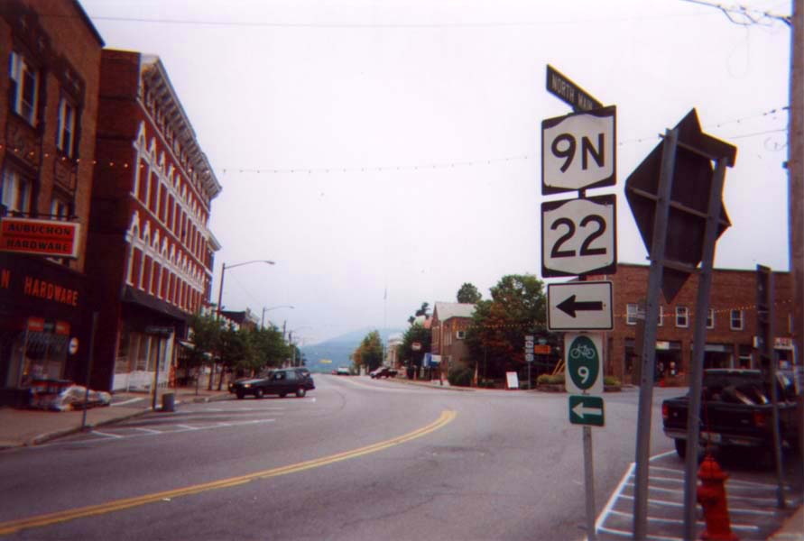
Far less impressive is the central business district of White Plains, another large residential city and seat of government for Westchester County. It seems that the commercial and civic activities once prevalent here have in large part migrated elsewhere and left their venues behind for us to remember. To the north of town we pass the Kensico Dam and hug the banks of its reservoir at the feet of lime-laden slopes. The high-capacity thoroughfare soon gives way to a more sedate two-lane roadway, bringing us into an area that alternates between old New England-style village greens (Armonk, Bedford, Katonah) and secluded areas of woodland adjacent to several of the New York City water supply reservoirs (Cross River, New Croton, Titicus). The entire distance to Brewster exhibits an air of the utmost graciousness and haute vie, which we may enjoy at our leisure owing to a vigorously sustained stasis in road development that keeps pavement narrow, curves tight, and speeds low.
Lithely edging its way across Interstate and railroad, NY 22 joins with US 202 at Croton Falls and accompanies it into Brewster. White spires and shadowy viaducts crowd together in this tight little village, situated at the base of a wooded hollow, and resembling any number of small towns in nearby Connecticut. Brewster is a gateway to New York from Connecticut, and to Westchester County from Upstate; a number of major highways converge here. Beyond this point, we begin our long ride through the swampy Harlem Valley, named for the railroad that was early a fierce competitor with the water-level Hudson River Railroad for the New York-to-Albany passenger market. The latter eventually won, but the Harlem Valley route is still used by the Metro-North Commuter Railway to serve a phalanx of whistle stops-turned-commuter retreats. This area is also Quaker country; the village of Pawling in particular was settled by members of this group and their history is well remembered in the names of roads, lakes and hills.
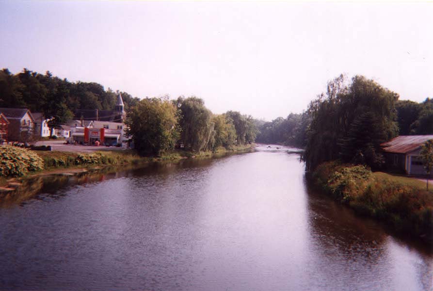
The valley is occupied by no single river, but by a succession of meandering streams flowing between low hills, forming a break between the Hudson Highlands and the Connecticut Taconics. The land of the valley is flat and grassy, yellow in summer against the green of the wooded slopes. Homes and modest business cluster around the various stations along the railroad: Wingdale, Dover Plains, Wassaic. Dover Furnace is a remnant of the iron ore industry which once flourished throughout the valley.
North of Amenia, a modest crossroads settlement, the countryside begins to appear somehow richer. Indeed, the landscape of northeastern Dutchess County is of the most delightful character anywhere in the State. The yellow pastures seem more golden; the green hills, rising in elevation as we enter the New York Berkshires, become more emerald. US 44 joins up with NY 22 at Amenia and branches off again at Millerton, another old iron center. Just to the north, NY 22 passes Boston Corner, a wedge of land ceded to New York by Massachusetts in the mid-nineteenth century. This spot, being the most distant from Boston and isolated from the rest of the state by impenetrable mountains, became such a haven for lawlessness that Massachusetts law enforcement agents were quite powerless here.
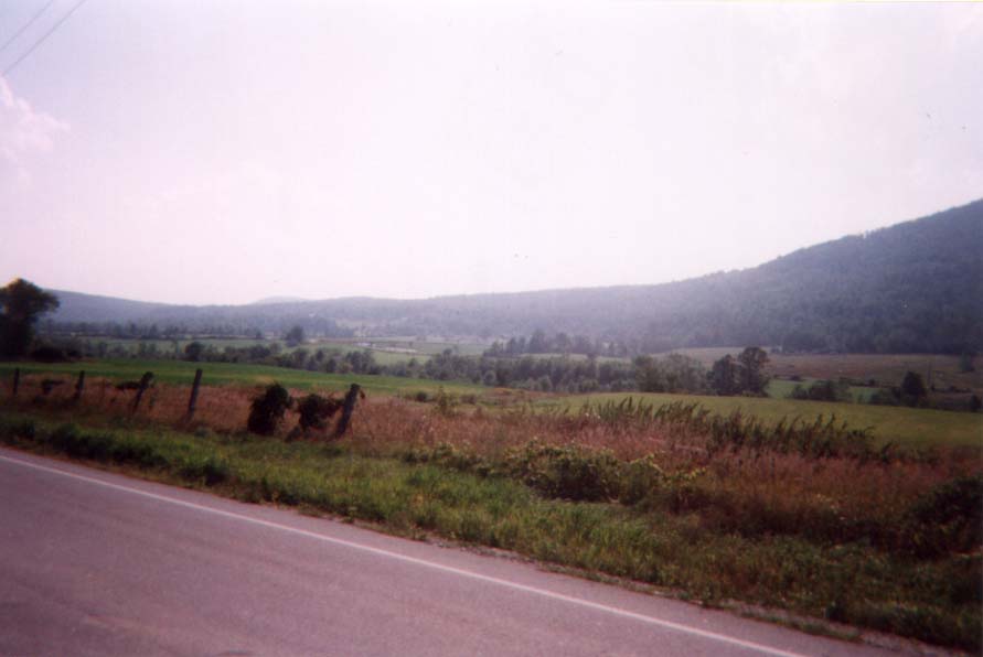 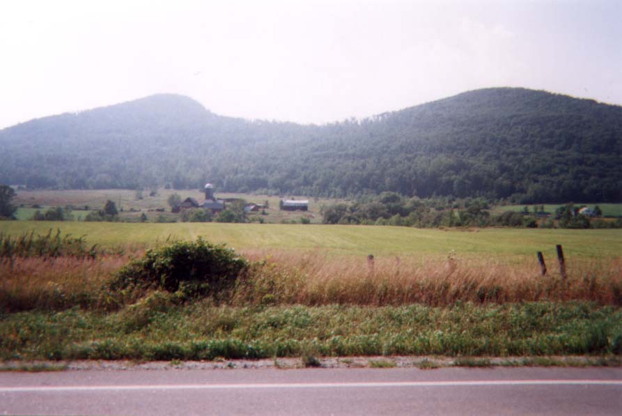 |
Typical scenery for NY 22. This example is in Essex County, between Whallonsburg and Essex. |
In Columbia County, NY 22 continues through pleasant pastures stockaded on the east by the Taconic Range of mountains. At Copake Falls is a remote entrance to Massachusetts (via NY 344) beside tumbling Bash Bish Brook. The falls of this stream, just across the state line, form a unique spectacle as they spill over a sheer rock wall, only to be sliced neatly in half by a sharp boulder projecting from the cliff face. This region of New York State has a subtle but unique character: less affluent than the resort area of Berkshire County, Massachusetts, but possessing a more pastoral tranquility than the lands west of the Hudson. NY 22 winds through narrow, sparsely settled valleys, nearly clipping the state line at the crossing of the New York State Thruway's Berkshire Spur.
Through Hillsdale, Austerlitz, Canaan and New Lebanon in Columbia County, and then through Stephentown, Berlin and Petersburg in Rensselaer County, the surroundings change little. Finally, at Hoosick Falls, the woods and hills recede as NY 22 settles into the more gently rolling farmlands of Washington County, where the countryside just seems made for an early September evening's drive. We are now at the foothills of Vermont's Green Mountains, and the villages of this stretch (Cambridge, Salem, Granville) carry an atmosphere proprietary to that state. The route bypasses Granville to the west, and strikes out across the hinterland through a string of small hamlets, towards the Champlain Canal.
Just beyond the Great Meadow Correctional Facility, we join US 4 beside the canal. This important corridor connects the Hudson River at Fort Edward with Lake Champlain at Whitehall. The resultant commercial artery was one of the principal thoroughfares of the Revolution, and control of the area was strategically crucial. The two highways, NY 22 and US 4, run in common to Whitehall. This place, the northern terminus of the New York State Barge Canal system, was the primary industrial center for this region, and today its many utilitarian brick-and-mortar buildings lining its lock-side main street recall this old vitality.
West of Whitehall, NY 22 crosses South Bay, one of the headpoints of Lake Champlain (the other, so-called East Bay, is indistinguishable from a small river). It then climbs, dips, and twists over a steep but narrow range of mountains, the sole natural separation between Lakes George and Champlain. From the crest, roads lead down to secluded settlements on Lake George and old railroad depots on Lake Champlain. At the northern end of the ridge sits Ticonderoga, famous for its pencils as well as its fort. Being on the old carrying place between water routes to Canada and New York City made this a much-coveted passage and necessitated the building of Fort Ticonderoga.
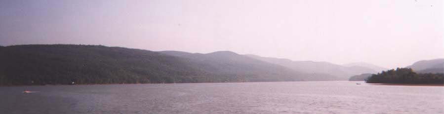 |
South Bay as seen from NY 22. |
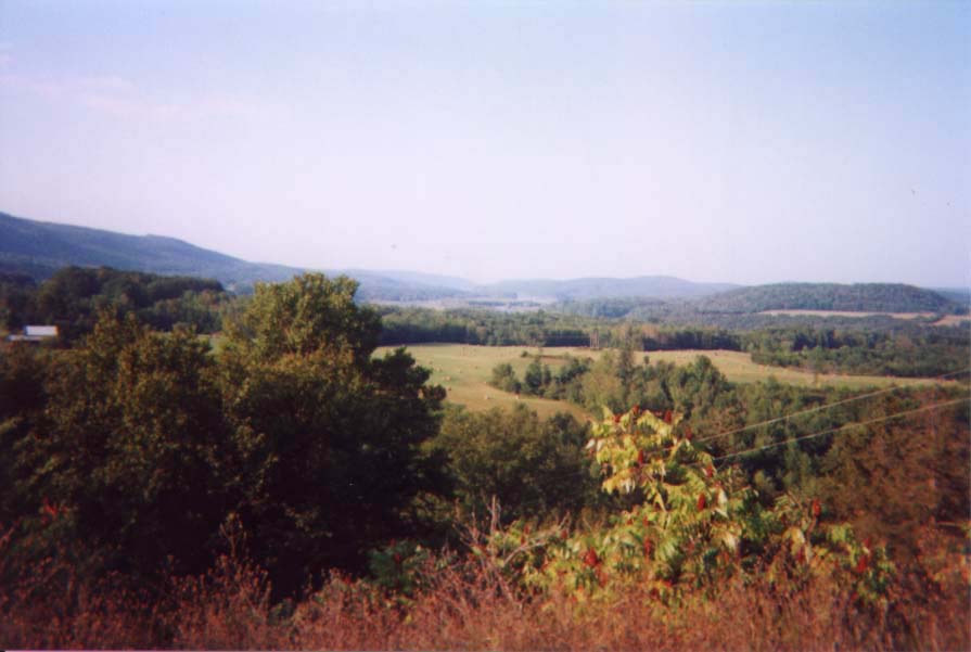 |
A parking area in the Town of Dresden offers this view. What appears to be a small river is actually the southern extremity of Lake Champlain. Beyond are the mountains of Vermont. |
Our route skims the outskirts of Ticonderoga and enters upon a journey through yet another type of countryside. We follow, usually at some distance, the shore of crystal-blue Lake Champlain, although the road does head inland across dairy pastures to avoid some of the more forbidding points and promontories. The towns we pass (Port Henry, Westport, Essex, Willsboro) are tourist gateways, whether for skiers, leaf-peepers, or plain old summer vacationists. Some are stops on the scenic single-track passenger railroad running between Schenectady and Montréal, others are landing points for the Vermont ferries, all offer recreational diversions of every kind.
From Willsboro the highway climbs between forested hills at the Adirondack outskirts, then joins US 9 on its way into Keeseville, situated on the Ausable River and straddling the line of Essex and Clinton Counties. Curving through the hamlet of Peru and around the edge of the defunct air force base, we make our way into the city of Plattsburgh. This northeasternmost city in New York lies at the mouth of the Saranac River on Lake Champlain. The river provided power for mills and an outlet for lumber cut in the interior forests; the waters near the city saw a number of important engagements of both the Revolution and the War of 1812. Today, the downtown streets are given an unusual, youthful vitality by the comparative remoteness of the city and the presence of one of the State University colleges. The place has an adventurous, somewhat bohemian quality; it is considered something of a sister city to Burlington, Vermont, across the lake. All over town are located extravagant old mansions, in varying stages of disrepair, and on the shore, the summer waters appear all the more blue on account of the distant backdrop of green Vermont hills. To best enjoy this city, however, we must stray slightly from our route, for NY 22 traverses a most nondescript section of town.
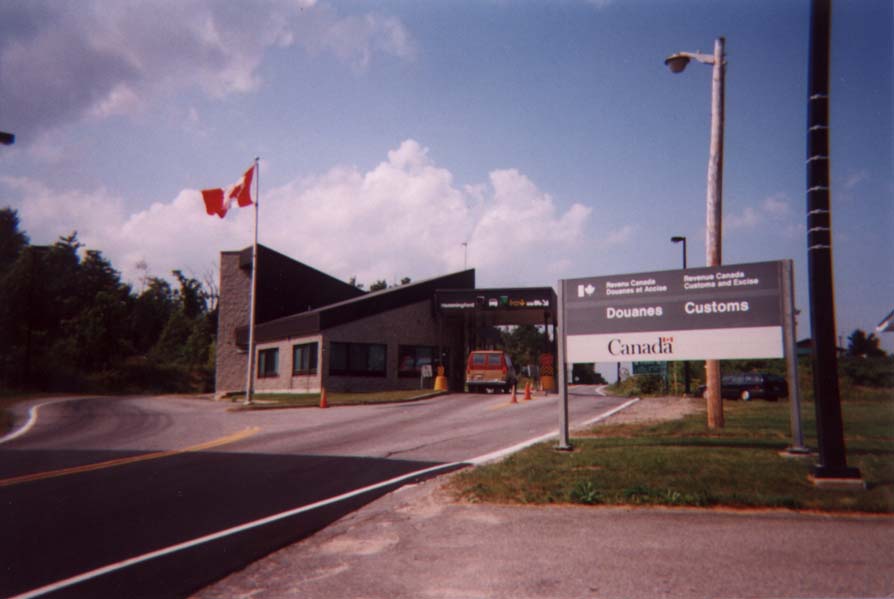 |
The customs station at the Canadian border. The road continues on as Québec Provincial Highway 219. |
The route's final stretch takes it through
a sparsely-populated area, still recovering from the scourge of the lumber
industry. The predominant ethnicity of this region is French Canadian,
with good reason: a short distance north of Mooers NY 22 comes to an end
at the Canadian border, 35 miles south of Montréal and ten times
that distance from New York City.
< Back