
Orthophoto Image Mosaics
Metropolitan Areas
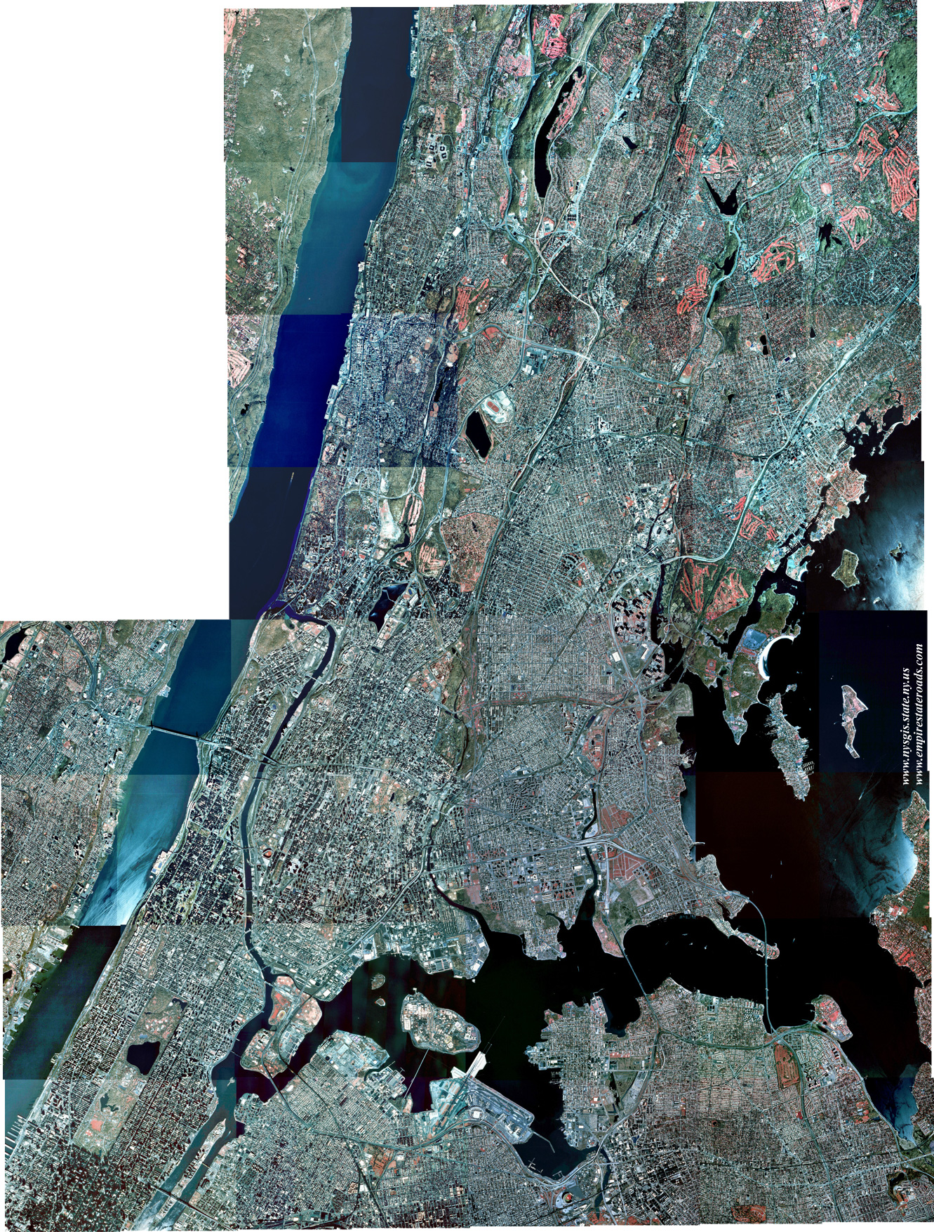
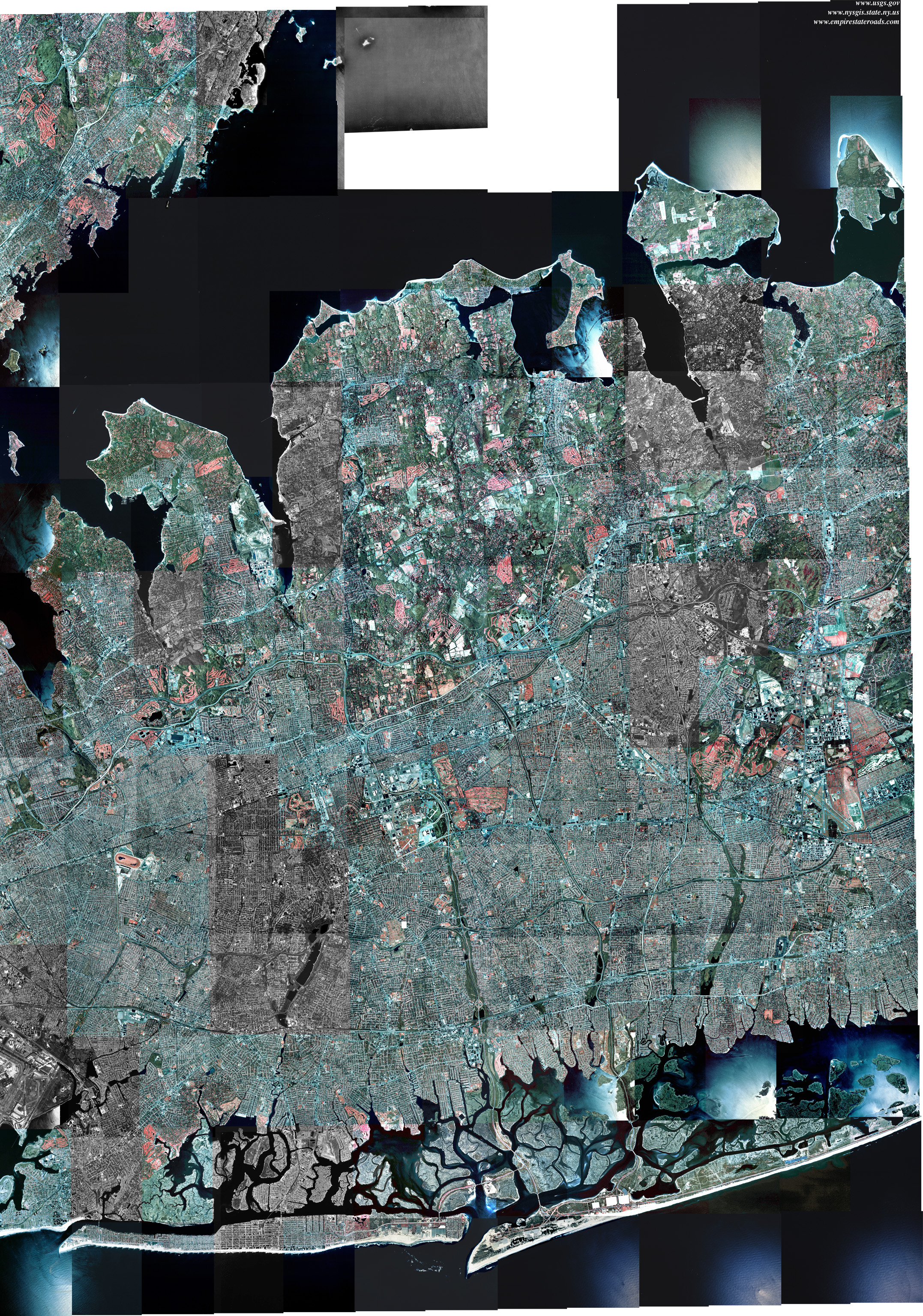
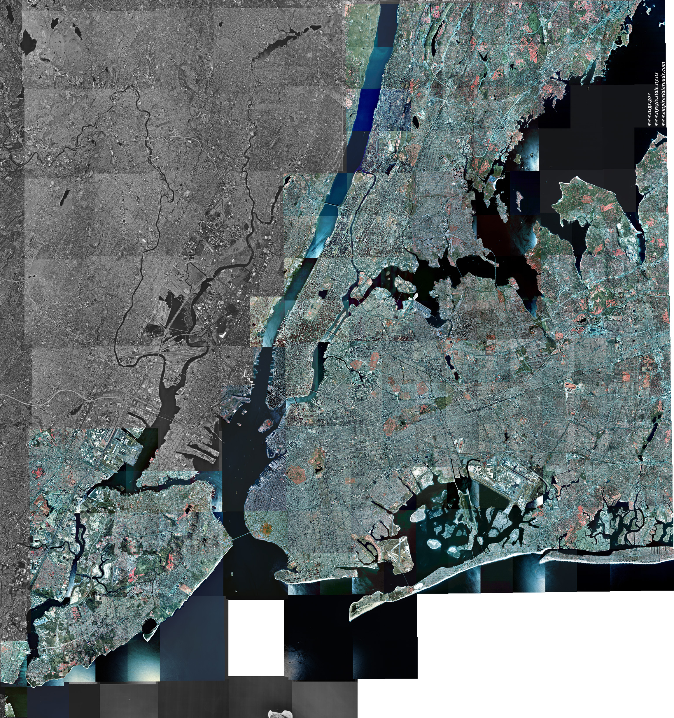 Coverage expanded! (3.04 Mb) - This
mosaic covers all five Boroughs of the City of New York, along with
much of southern Westchester and western Nassau Counties. Coverage
includes the cities of Yonkers, Mount Vernon, New Rochelle, Rye, Long
Beach and part of Glen Cove. Also shown are Mamaroneck, Mineola,
Lynbrook, Port Washington, and parts of Port Chester and Hempstead. Now
displays northeastern New Jersey, from Perth Amboy to Alpine and from
Bayonne to Paterson. Includes all available
imagery from the following qudrangles: Arthur Kill, Brooklyn, Central
Park, Coney Island, Elizabeth, Far Rockaway, Flushing, Jamaica, Jersey
City, Keyport, Lawrence, Lynbrook, Mamaroneck, Mount Vernon, Perth
Amboy, Sea Cliff, South Amboy, The Narrows, Weehawken and Yonkers.
Coverage expanded! (3.04 Mb) - This
mosaic covers all five Boroughs of the City of New York, along with
much of southern Westchester and western Nassau Counties. Coverage
includes the cities of Yonkers, Mount Vernon, New Rochelle, Rye, Long
Beach and part of Glen Cove. Also shown are Mamaroneck, Mineola,
Lynbrook, Port Washington, and parts of Port Chester and Hempstead. Now
displays northeastern New Jersey, from Perth Amboy to Alpine and from
Bayonne to Paterson. Includes all available
imagery from the following qudrangles: Arthur Kill, Brooklyn, Central
Park, Coney Island, Elizabeth, Far Rockaway, Flushing, Jamaica, Jersey
City, Keyport, Lawrence, Lynbrook, Mamaroneck, Mount Vernon, Perth
Amboy, Sea Cliff, South Amboy, The Narrows, Weehawken and Yonkers.
Although this mosaic is presented in a smaller scale than the individual borough mosaics (see below), its coverage exceeds the sum of those images.
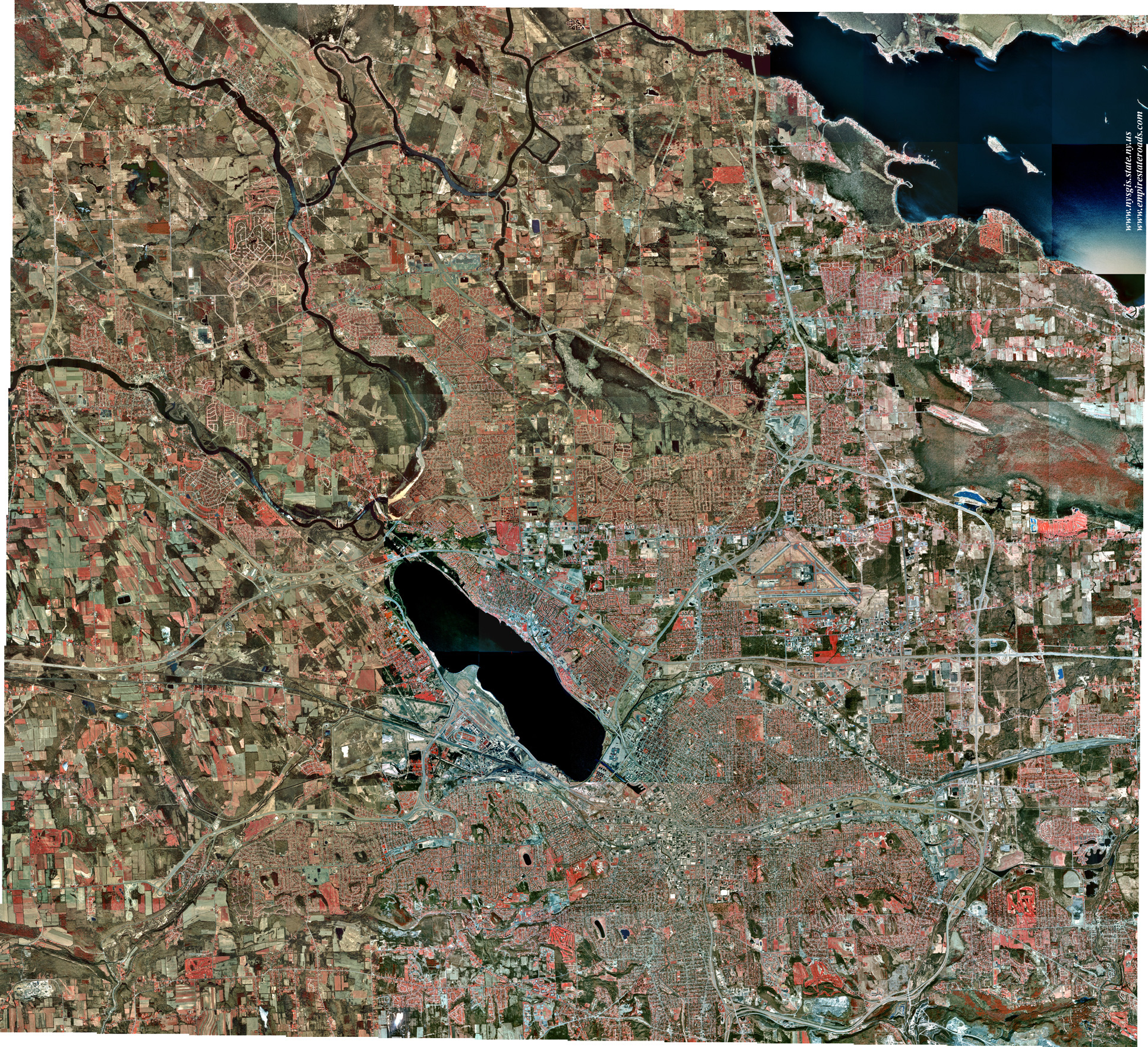
Albany-Schenectady-Troy (2.76 Mb)
This mosaic shows the three main cities of the Capital District, along with Cohoes, Rensselaer and Watervliet. Also included are Colonie, Scotia, Voorheesville, Waterford and Clifton Park. Compiled from Albany, Niskayuna, Schenectady, Troy North, Troy South and Voorheesville quadrangles.
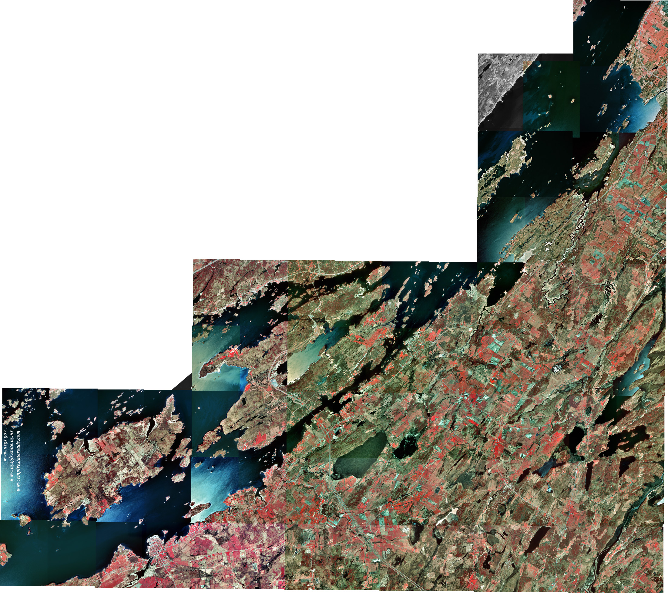
Alexandria Bay-Clayton
(1.59 Mb)
Covers the heart of the Thousand Islands region, centering on Wellesley
Island. Extends along the St. Lawrence River from Grindstone Island to
Chippewa Bay, including the resort villages of Alexandria Bay and
Clayton. Compiled from Alexandria Bay, Chippewa Bay, Gananoque,
Redwood, Thousand Island Park, and parts of Clayton, La Fargeville,
Saint Lawrence and Theresa quadrangles.
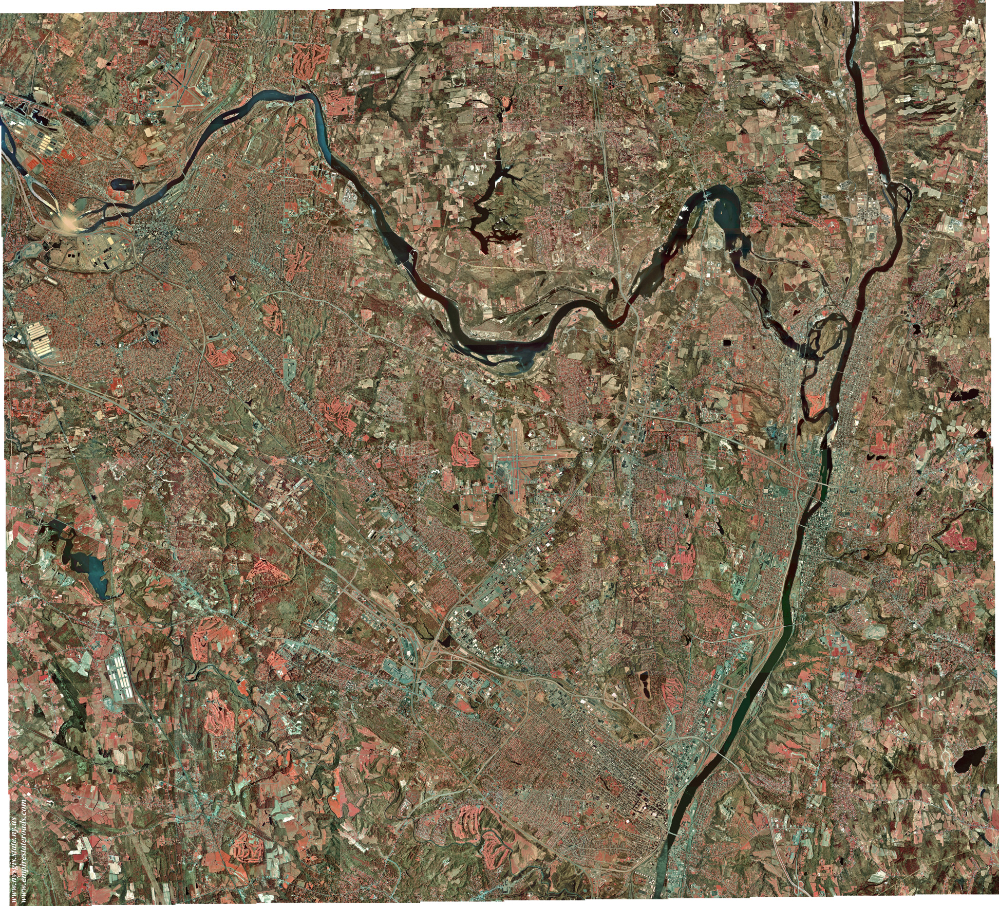
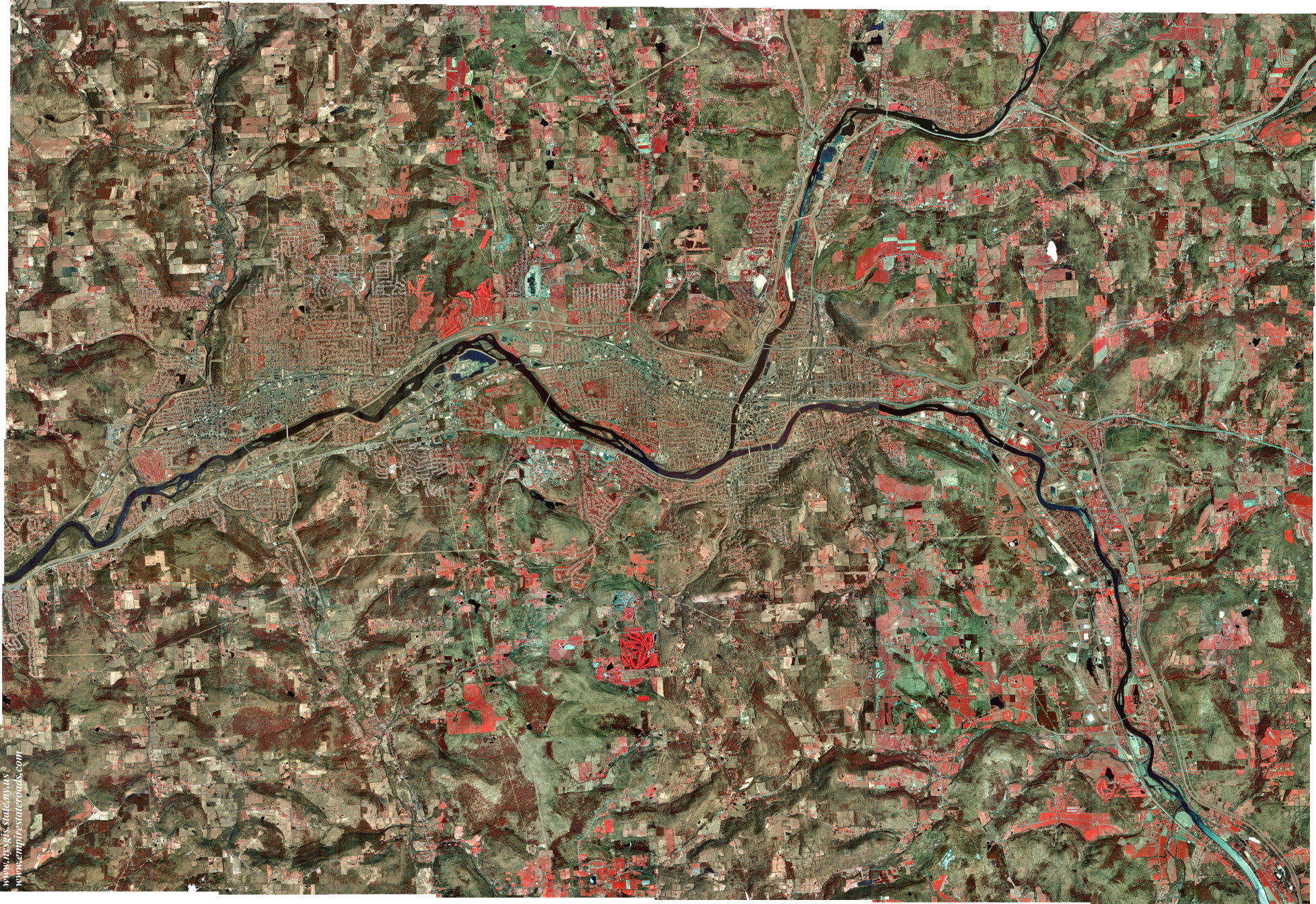
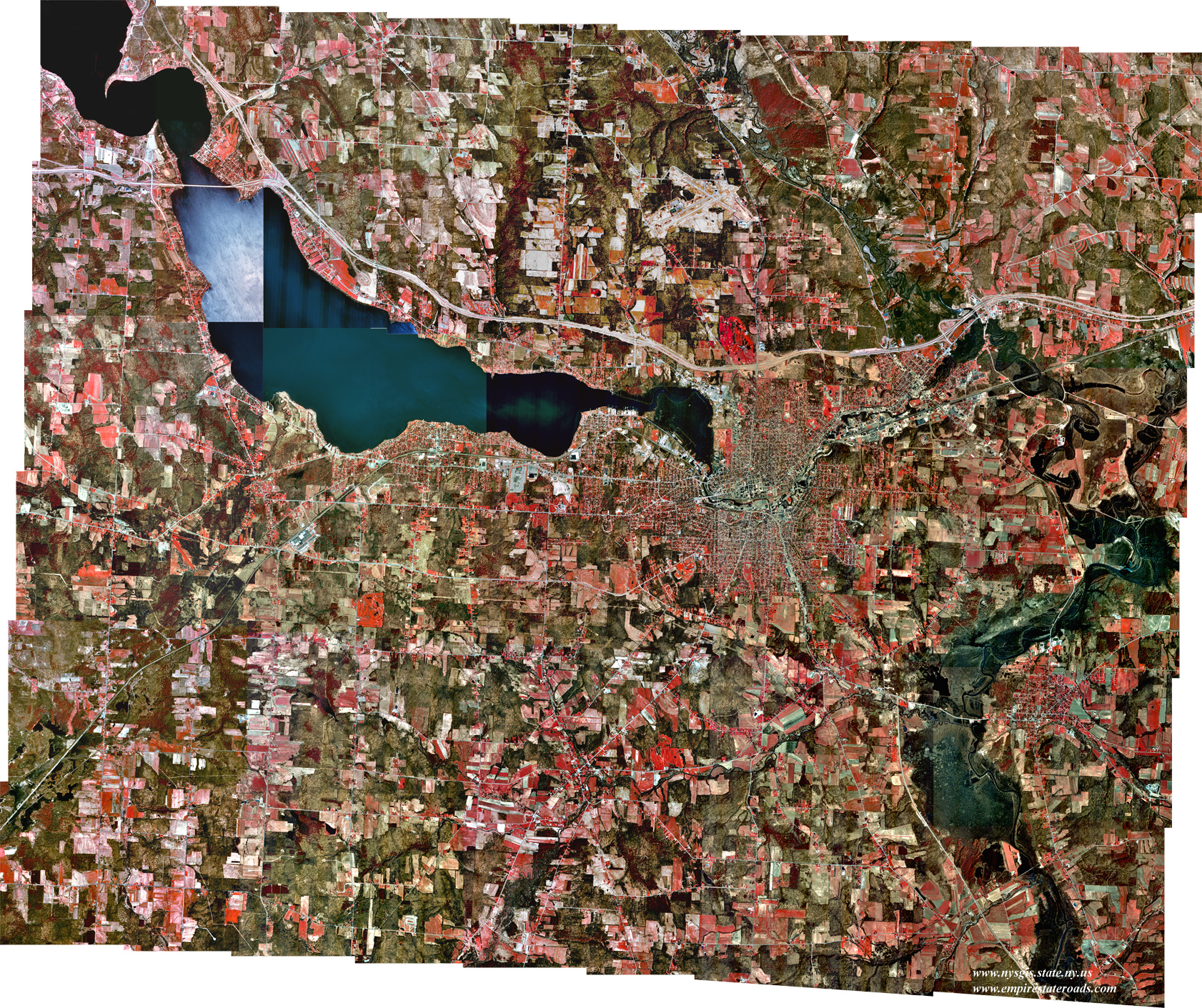
Binghamton (2.06 Mb)
Covers the City of Binghamton along with Johnson City and Endicott.
Also shows Kirkwood, Conklin, Vestal, Port Dickinson, Chenango Bridge
and Port Crane; coverage extends to the Pennsylvania state line.
Compiled from Binghamton East, Binghamton West, Endicott, and parts of
Castle Creek, Chenango Forks and Maine quadrangles.
Brockport-Hilton
(2.45 Mb)
Covers the western portion of Monroe County, including the Villages of
Brockport, Churchville, Hilton, Scottsville and Spencerport. Also
includes Hamlin, North Chili and the Village of Bergen. Compiled from
Brockport, Churchville, Clifton, Hamlin, Hilton and Spencerport
quadrangles.
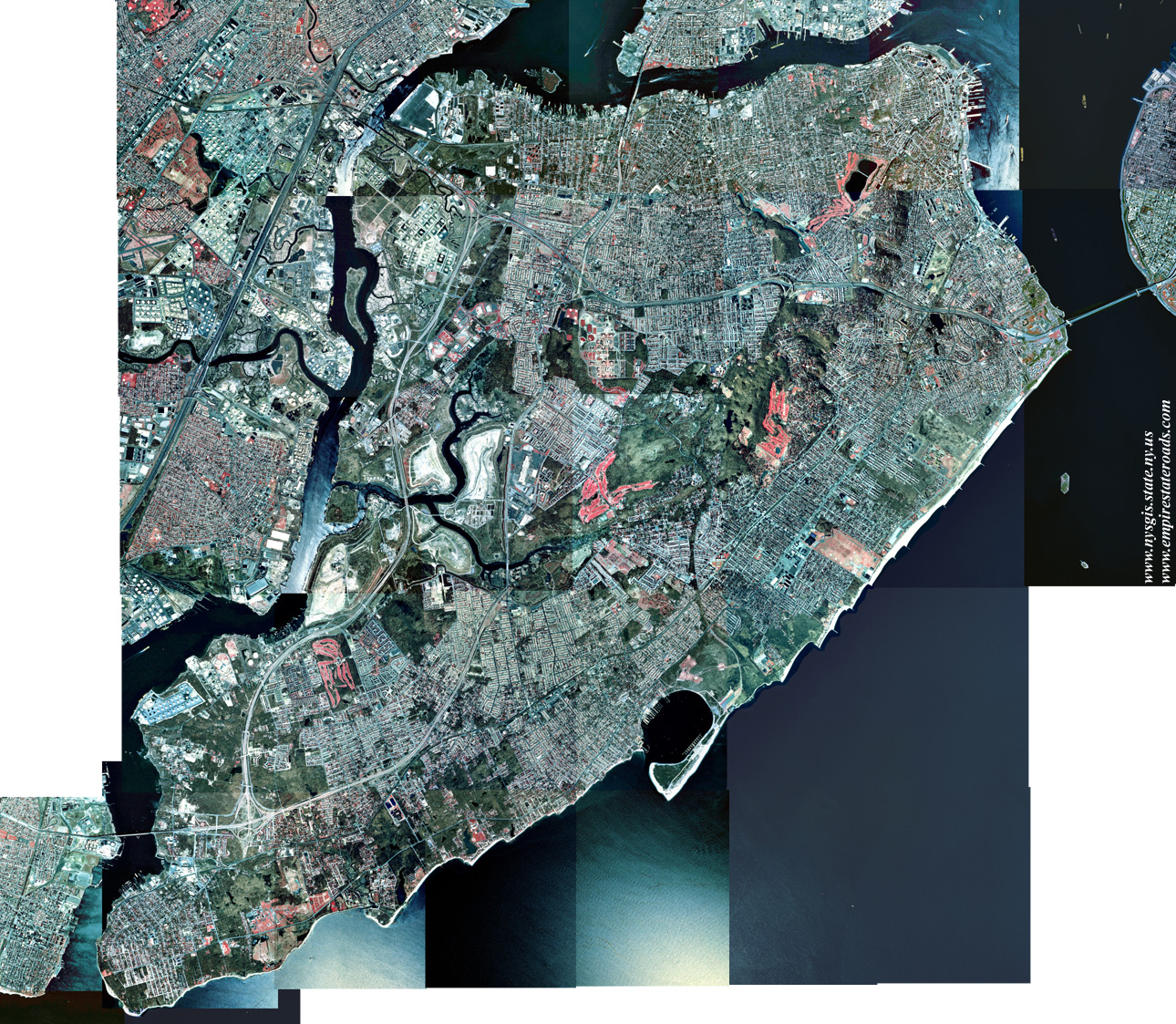
Bronx-Yonkers (1.72 Mb)
Covers the Borough of Bronx (plus northern Manhattan and the north
shore of Queens) in New York City, and the Cities of Yonkers, Mount
Vernon and New Rochelle in Westchester County. Also includes Fort Lee
and Alpine, New Jersey. Compiled from Central Park, Flushing, Mount
Vernon and Yonkers quadrangles.
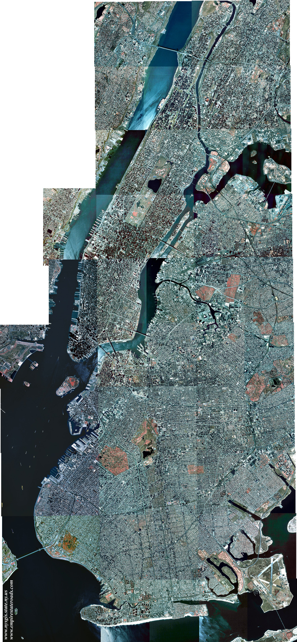
Brooklyn-Manhattan
(1.49 Mb)
Covers the Boroughs of Brooklyn and Manhattan, as well as northwestern
Queens and southwestern Bronx, in New York City. Also includes
Weehawken, Fort Lee and Port Liberte, New Jersey. Compiled from
Brooklyn, Central Park and Coney Island quadrangles, and portions of
Jersey City, The Narrows and Weehawken quadrangles.
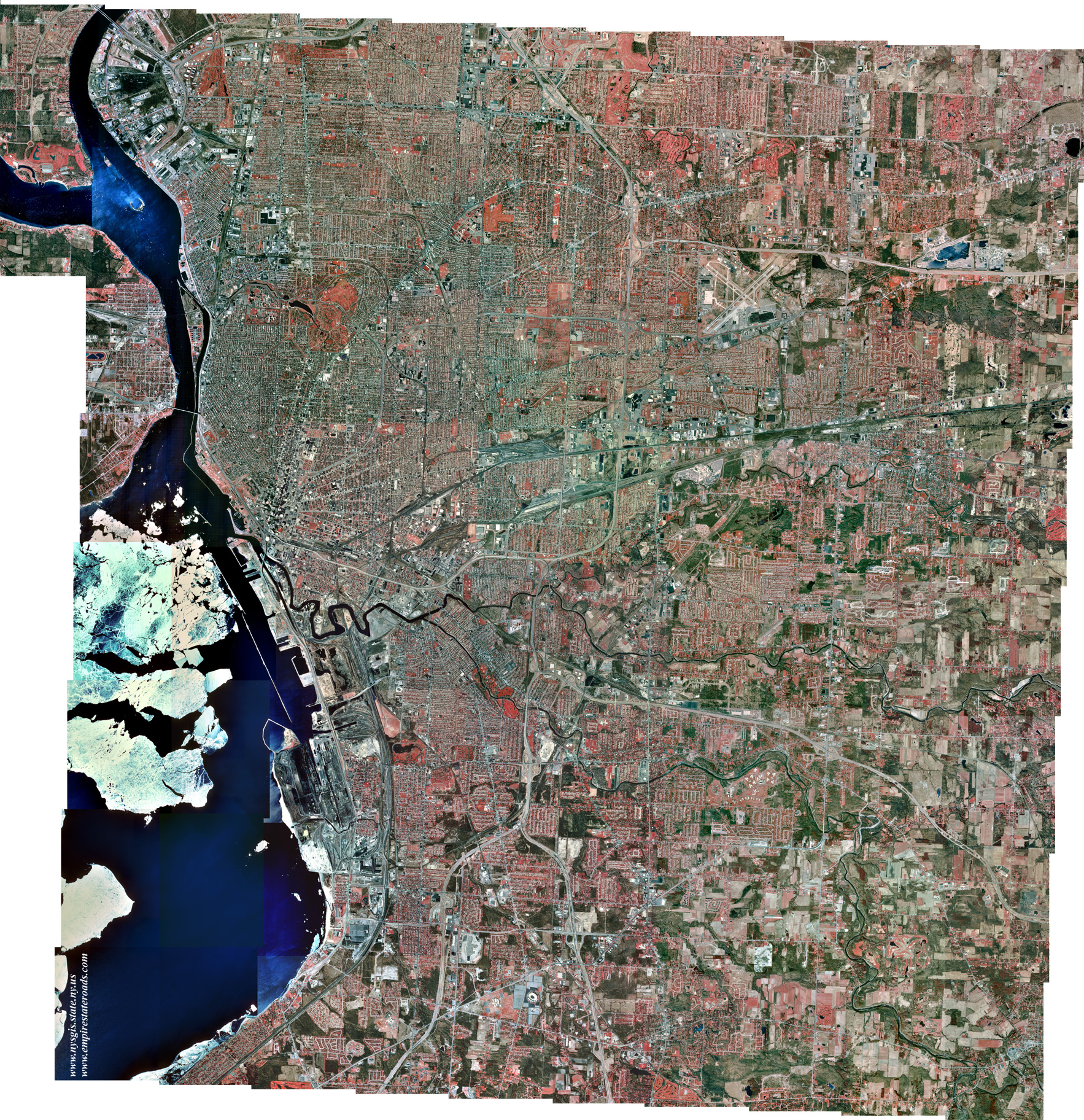
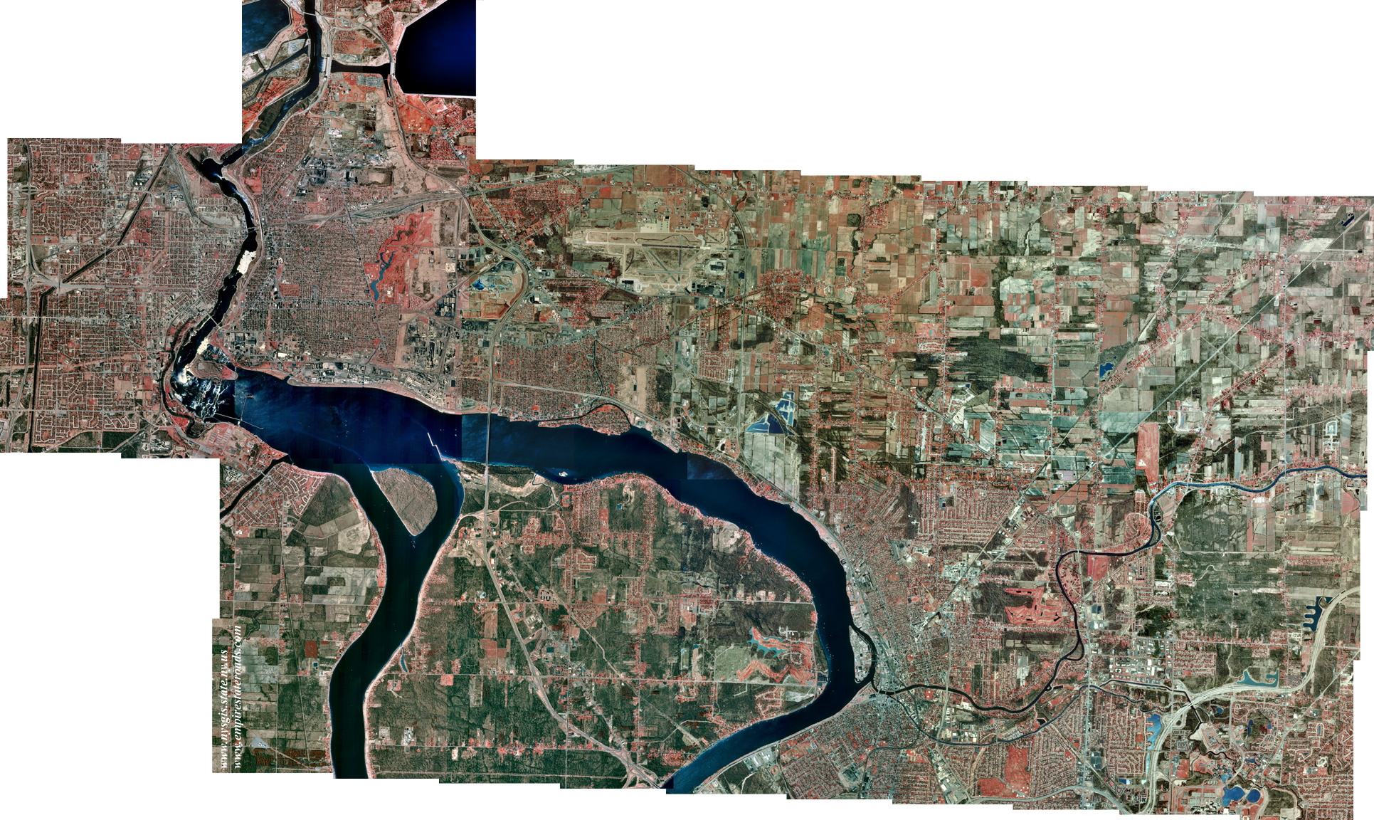
Buffalo (2.32 Mb)
Covers the City of Buffalo and immediate vicinity, including
Lackawanna, Sloan, Kenmore and downtown Fort Erie, Ontario. Also
depicts Williamsville, Depew, Lancaster, Orchard Park and part of East
Aurora. Compiled from Buffalo NE, Buffalo NW (except part of Grand
Island), Buffalo SE, Lancaster and Orchard Park quadrangles.
Buffalo-Niagara (2.82
Mb)
This image combines the Buffalo and Niagara Falls metro area mosaics.
It displays an area stretching along the Niagara River from Lake Erie
to below Niagara Falls, including all of Grand Island.
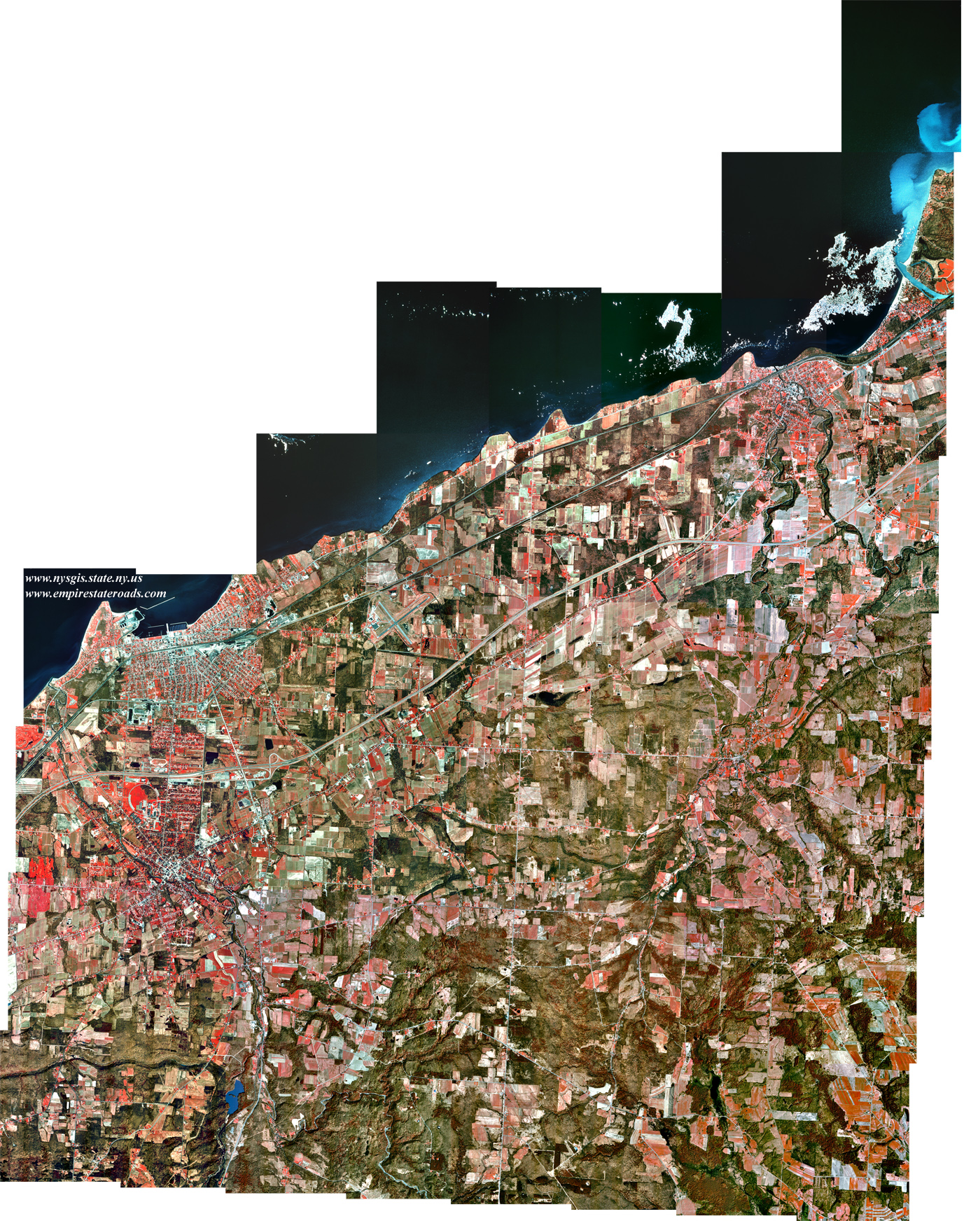
Dunkirk-Fredonia
(1.72 Mb)
Covers the City of Dunkirk and the Village of Fredonia, and extends
eastward to Forestville, Silver Creek and Sunset Bay. Compiled from
Dunkirk, Forestville, North of Dunkirk and Silver Creek quadrangles.
Elmira-Horseheads
(0.90 Mb)
Covers the City of Elmira and the Village of Horseheads, along with
Elmira Heights, West Elmira and Southport. Coverage extends north to
Pine Valley and south to the Pennsylvania state line. Compiled from
Elmira and Horseheads quadrangles.
Jamestown (2.34
Mb)
Covers the City of Jamestown and surrounding areas, including Lakewood,
Falconer, Celoron and Frewsburg. Coverage extends westward to the
narrows of Chautauqua Lake and the Village of Bemus Point. Compiled
from Jamestown, Lakewood, and parts of Chautauqua, Ellery Center, Gerry
and Panama quadrangles.
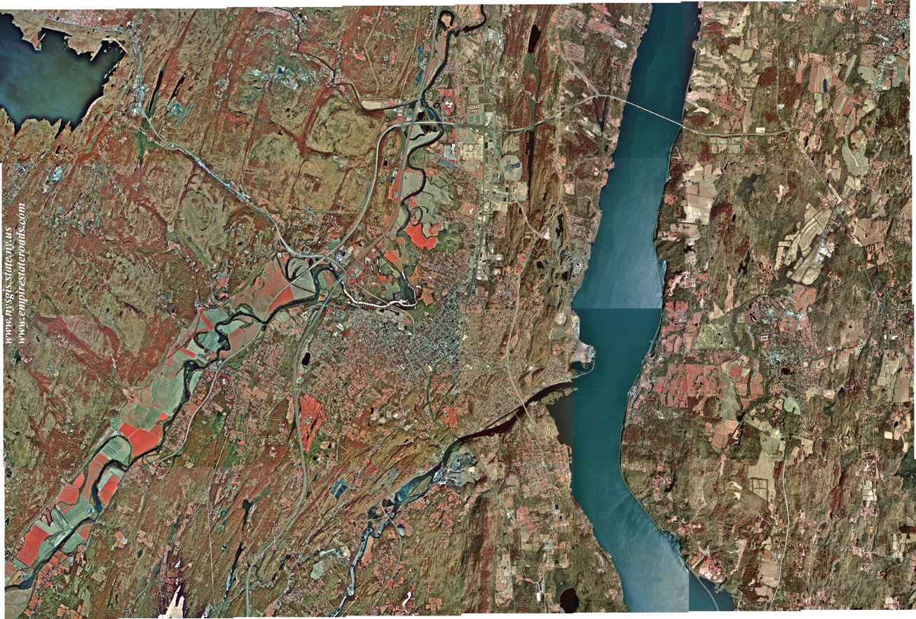
Kingston (0.88 Mb)
Covers the City of Kingston and adjacent areas, including Hurley, Port
Ewen, Rhinebeck, Rhinecliff and Red Hook. Compiled from Kingston East
and Kingston West quadrangles.
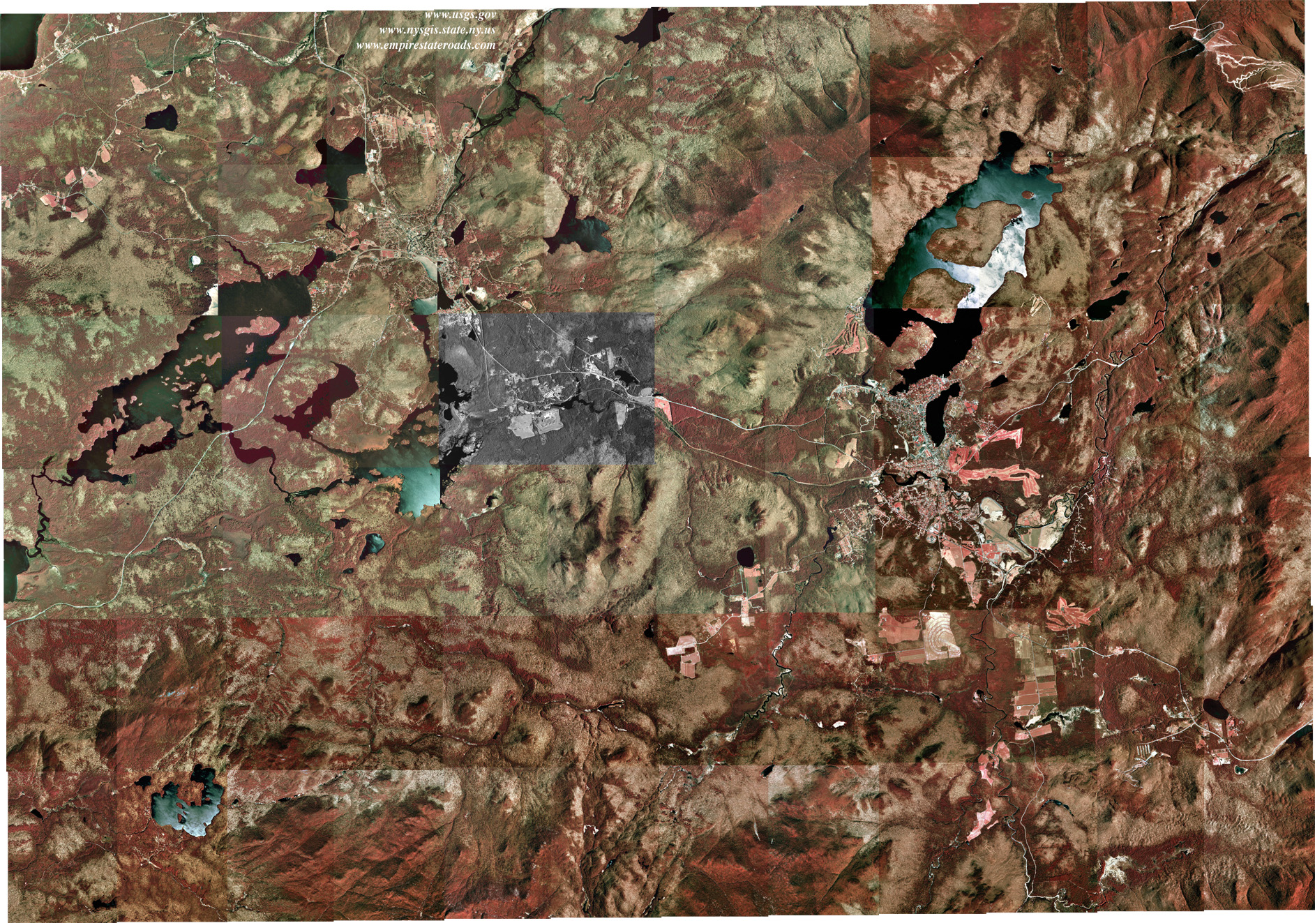
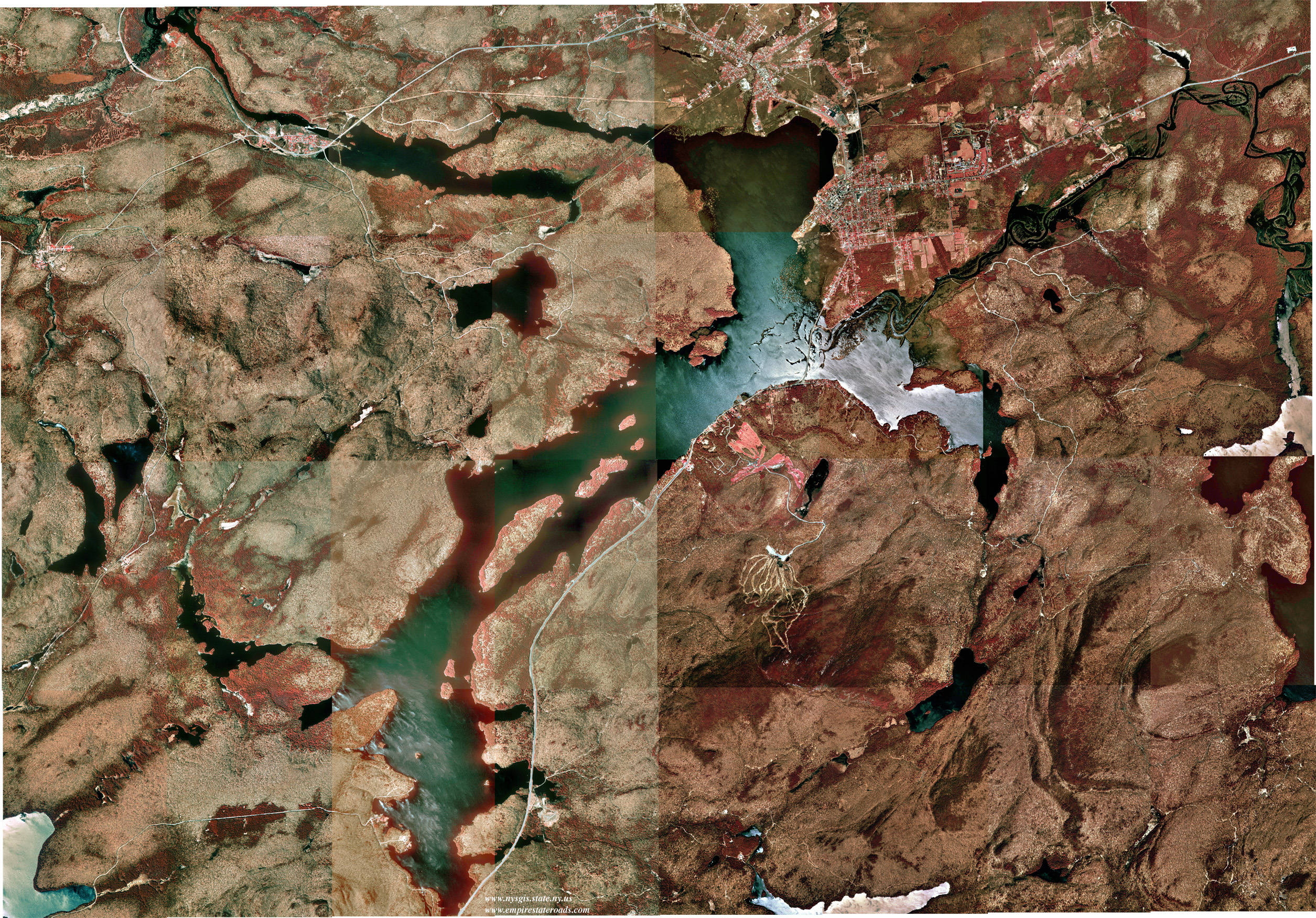
Lake Placid-Saranac Lake
(1.41 Mb)
Covers a section of the Adirondack region, including the Villages of
Lake Placid and Saranac Lake. Prominent lakes shown are Ampersand,
Colby, Kiwassa, Lower Saranac, Oseetah and Lake Placid. Also shows
Mount Van Hoevenberg and Whiteface Mountain, along with parts of the
Sawtooth and Ampersand ranges. Compiled from Lake Placid, McKenzie
Mountain, Saranac Lake, and parts of Ampersand, North Elba and Street
Mountain quadrangles.
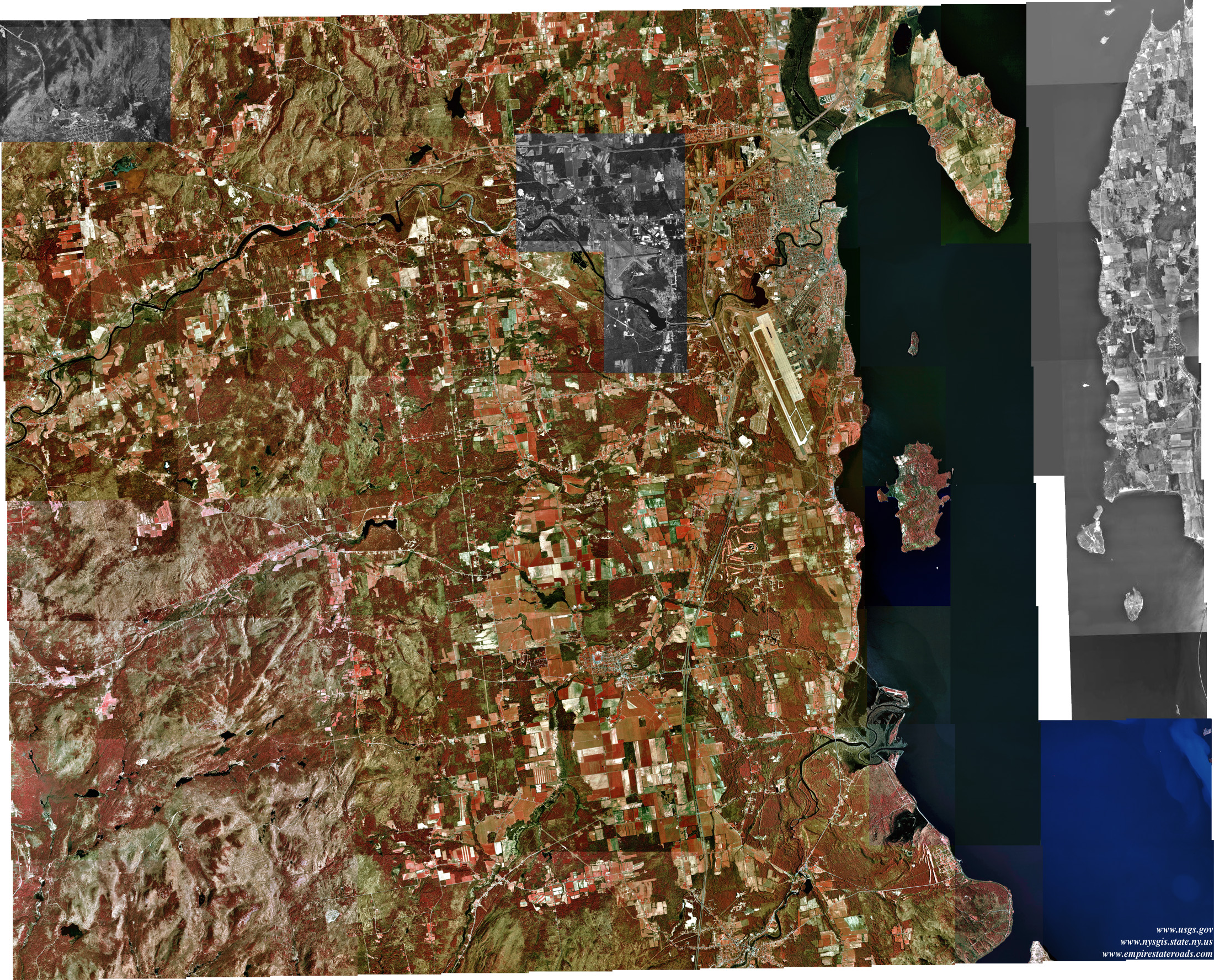
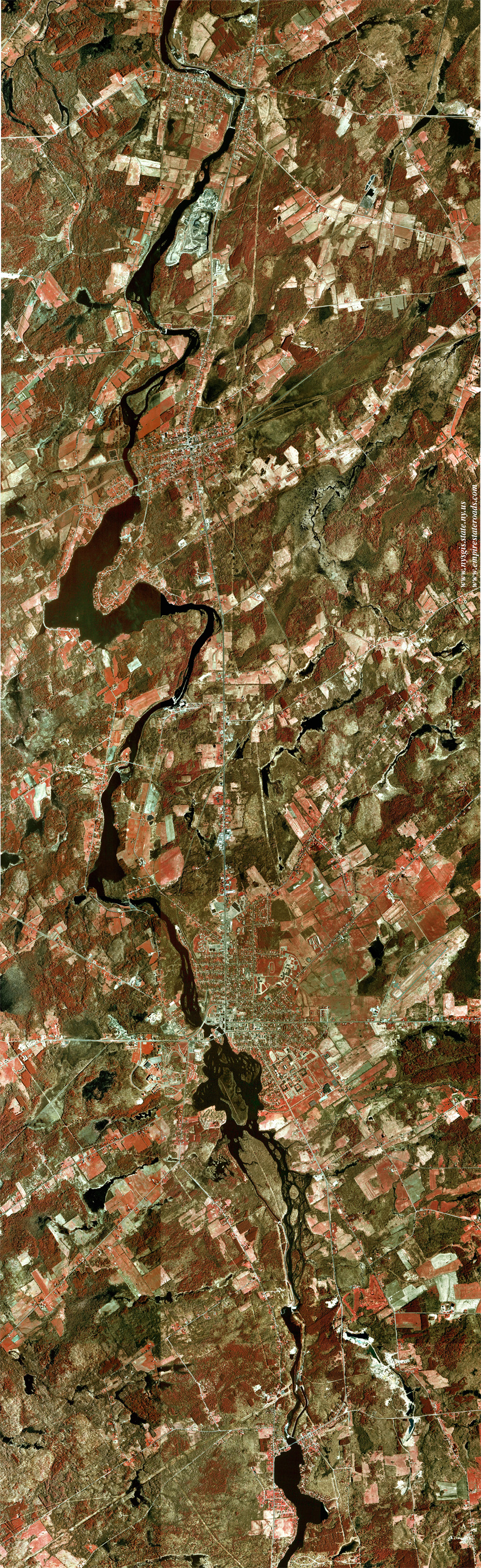
Massena (1.18 Mb)
Covers the Village of Massena and vicinity, including Rooseveltown and
Hogansburg. Displays the St. Lawrence Seaway Project, Robert Moses
State Park and the mouths of the Grass, Raquette and St. Regis Rivers.
Compiled from Cornwall West, Hogansburg, Massena and Raquette River
quadrangles.
NEW - Nassau County
(4.10
Mb)
Covers all of Nassau County and neighboring areas of Queens, Suffolk
and Westchester Counties, including Amityville, Huntington, Mamaroneck
and Rye. Compiled from Amityville, Bayville, Freeport, Hicksville,
Huntington, Jones Inlet, Lloyd Harbor, Lawrence, Lynbrook, Mamaroneck,
Sea Cliff, West Gilgo Beach and portions of Far Rockaway, Flushing,
Jamaica and Mount Vernon quadrangles.
Niagara Falls (1.24
Mb)
Covers the Cities of Niagara Falls, Tonawanda and North Tonawanda. Also
includes northern Grand Island and much of Niagara Falls, Ontario.
Compiled from Niagara Falls, Tonawanda East and Tonawanda West
quadrangles, and a portion of Lewiston quadrangle.
Niagara River (0.48 Mb)
Shows the lower Niagara River, from above the Falls to its mouth at
Lake Ontario. Includes part of the City of Niagara Falls, plus
Lewiston, Youngstown and Fort Niagara. Compiled from Fort Niagara,
Lewiston and Niagara Falls quadrangles.
Ogdensburg-Brockville
(2.39 Mb)
Covers the City of Ogdensburg and surrounding areas, including
Heuvelton and Morristown. Also includes the Canadian cities of
Brockville and Prescott, Ontario. Shows the St. Lawrence River from Oak
Point to Galop Island, and the northern portion of Black Lake. Compiled
from Edwardsville, Heuvelton, Morristown, Ogdensburg East, Ogdensburg
West and Red Mills quadrangles.
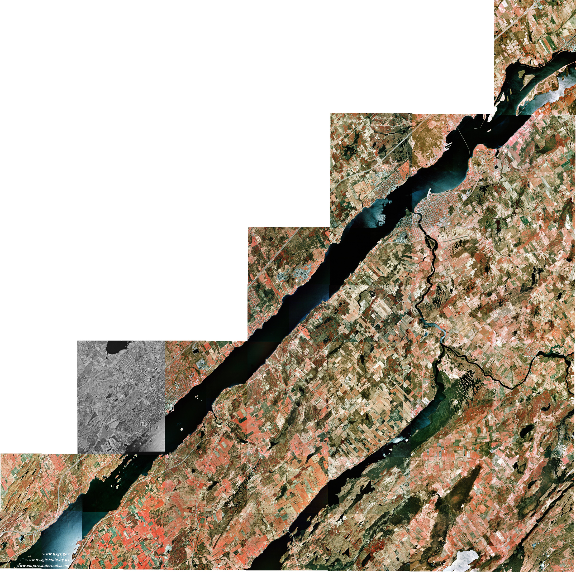
Plattsburgh
(2.22 Mb)
Covers the City of Plattsburgh and adjacent areas, extending west to
Dannemora and south to Keeseville. Also includes Morrisonville, Peru,
Port Kent, Schuyler Falls and Ausable Chasm. Compiled from Colchester
Point, Dannemora, Keeseville, Morrisonville, Peasleeville, Peru and
Plattsburgh quadrangles.
Potsdam-Norwood (2.15
Mb)
Covers the Villages of Potsdam and Norwood, along with other
communities on the Raquette River from Hannawa Falls to Norfolk. This
mosaic is presented at the same resolution (8 meters per pixel) as the
quadrangle-based images. Compiled from portions of Chase Mills, Colton,
Norfolk, Pierrepont, Potsdam and West Potsdam quadrangles.
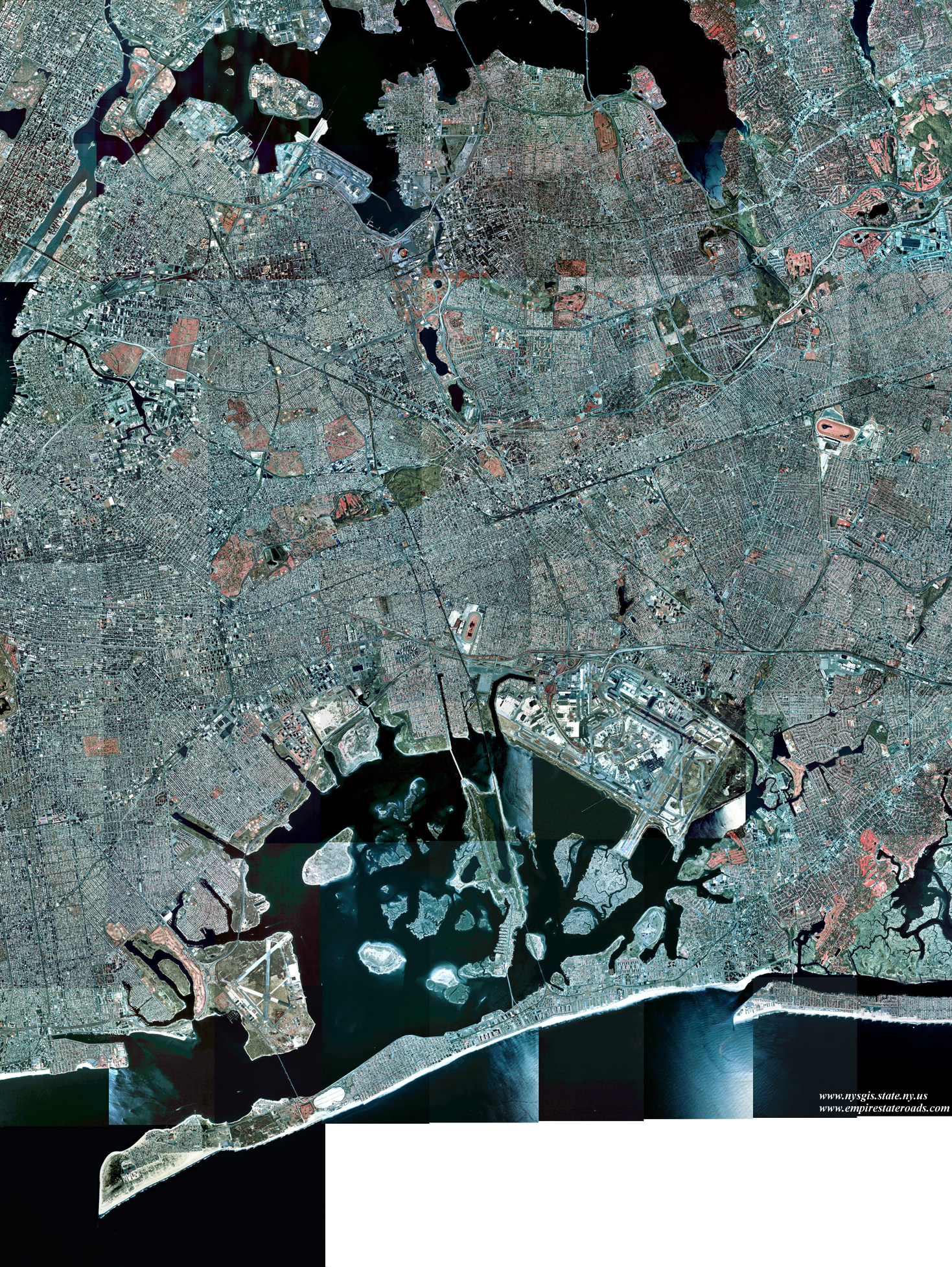
Queens (2.11 Mb)
Covers the Borough of Queens in New York City, as well as adjacent
areas of Brooklyn and Nassau County including Atlantic Beach, Valley
Stream and Great Neck. Compiled from Far Rockaway and Jamaica
quadrangles, and portions of Brooklyn, Central Park, Coney Island,
Flushing, Lawrence, Lynbrook and Sea Cliff quadrangles.
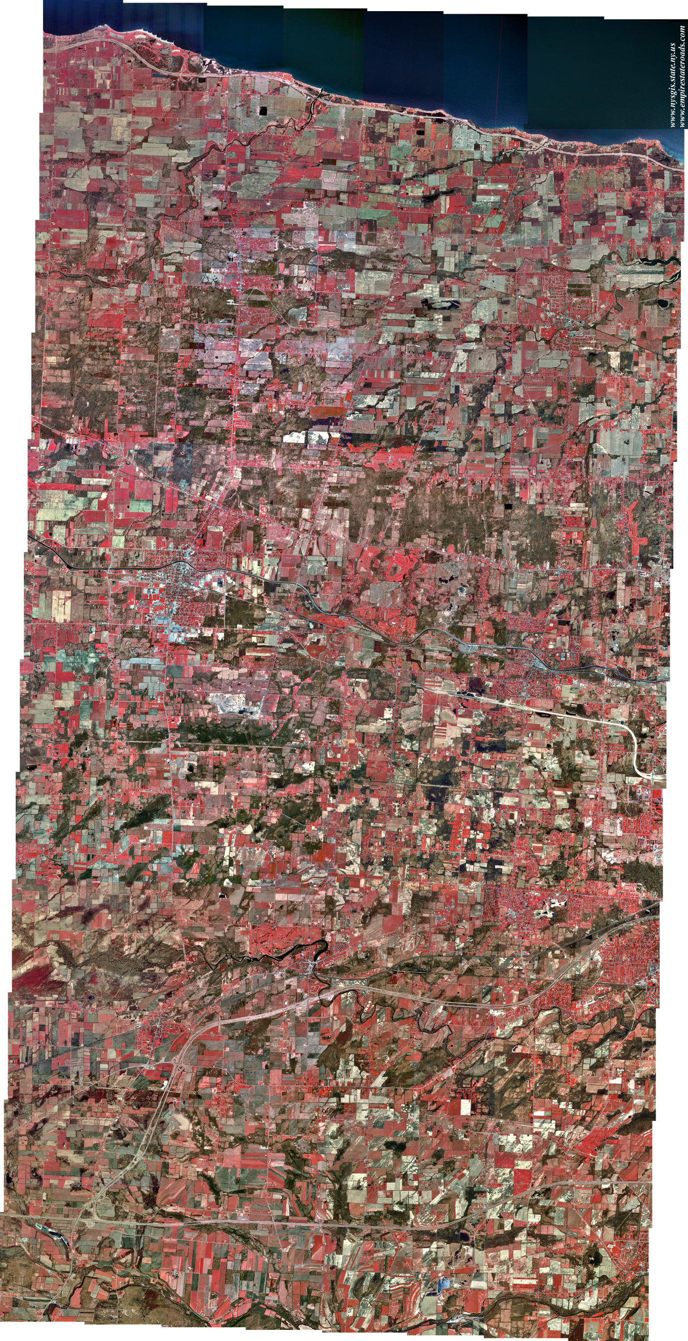
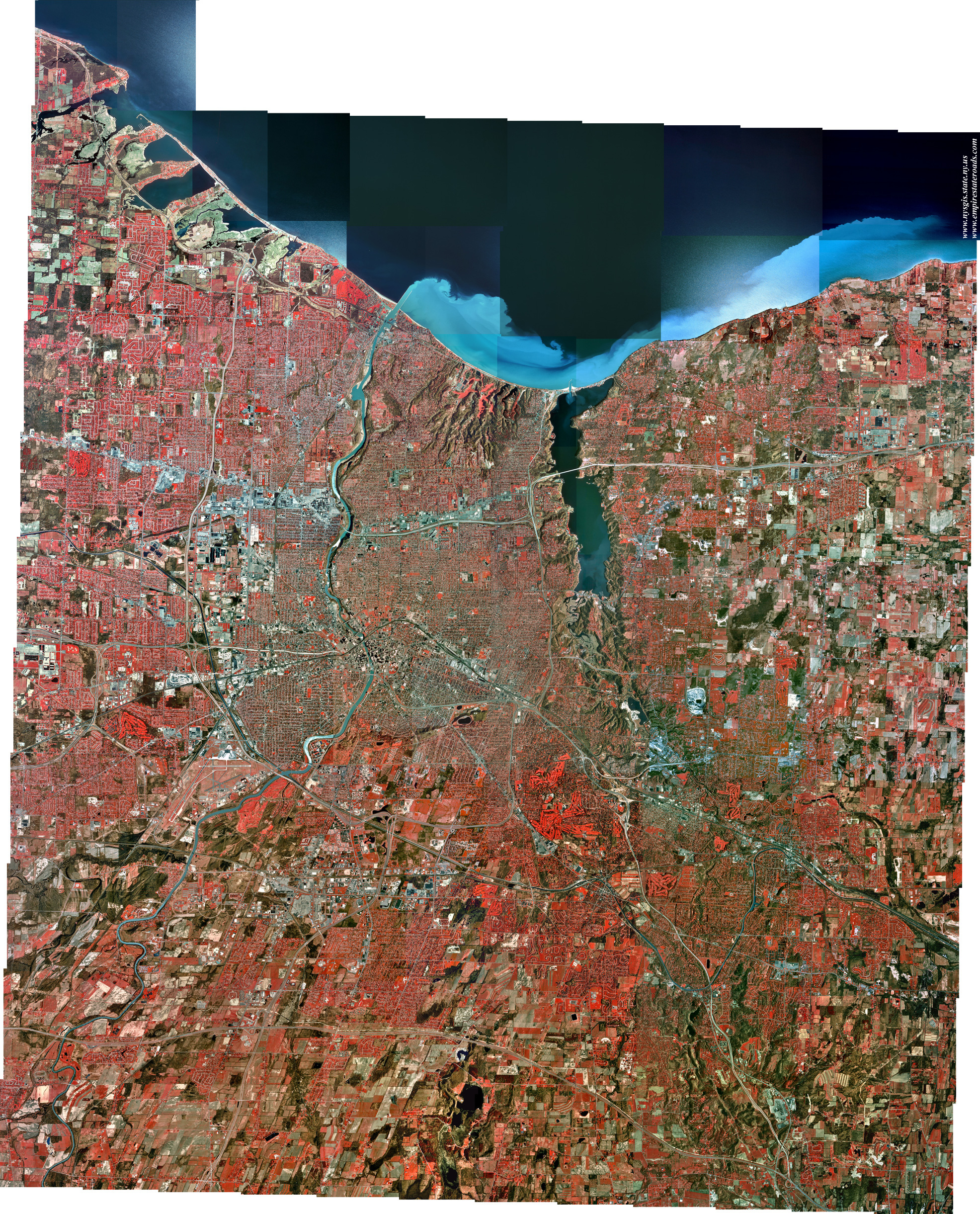
Rochester (3.52 Mb)
Covers the City of Rochester and its immediate suburbs. Stretches from
the Greece ponds to Mendon Ponds, and from Irondequoit Bay to part of
Scottsville. Also expanded to include Fairport, Webster and Fishers.
Compiled from Braddock Heights, Fairport, Ninemile Point, Pittsford,
Rochester East, Rochester West, Webster and West Henrietta quadrangles.
Staten Island (0.89 Mb)
Covers the Borough of Staten Island (Richmond County) and Carteret, New
Jersey. Also includes small portions of Bayonne, Elizabeth and Perth
Amboy, New Jersey. Compiled from Arthur Kill and parts of Elizabeth,
Jersey City and The Narrows quadrangles.
Suffolk County - Central
(2.66 Mb)
Covers the Town of Riverhead and most of Brookhaven,
along with the west part of the Town of Southampton. Coverage extends
from Sound Beach to Mattituck, Medford to Riverhead, and East Patchogue
to Hampton Bays. Compiled from Bellport, Eastport, Howells Point,
Mattituck, Mattituck Hills, Middle Island, Moriches, Pattersquash
Island, Quogue, Riverhead and Wading River quadrangles.
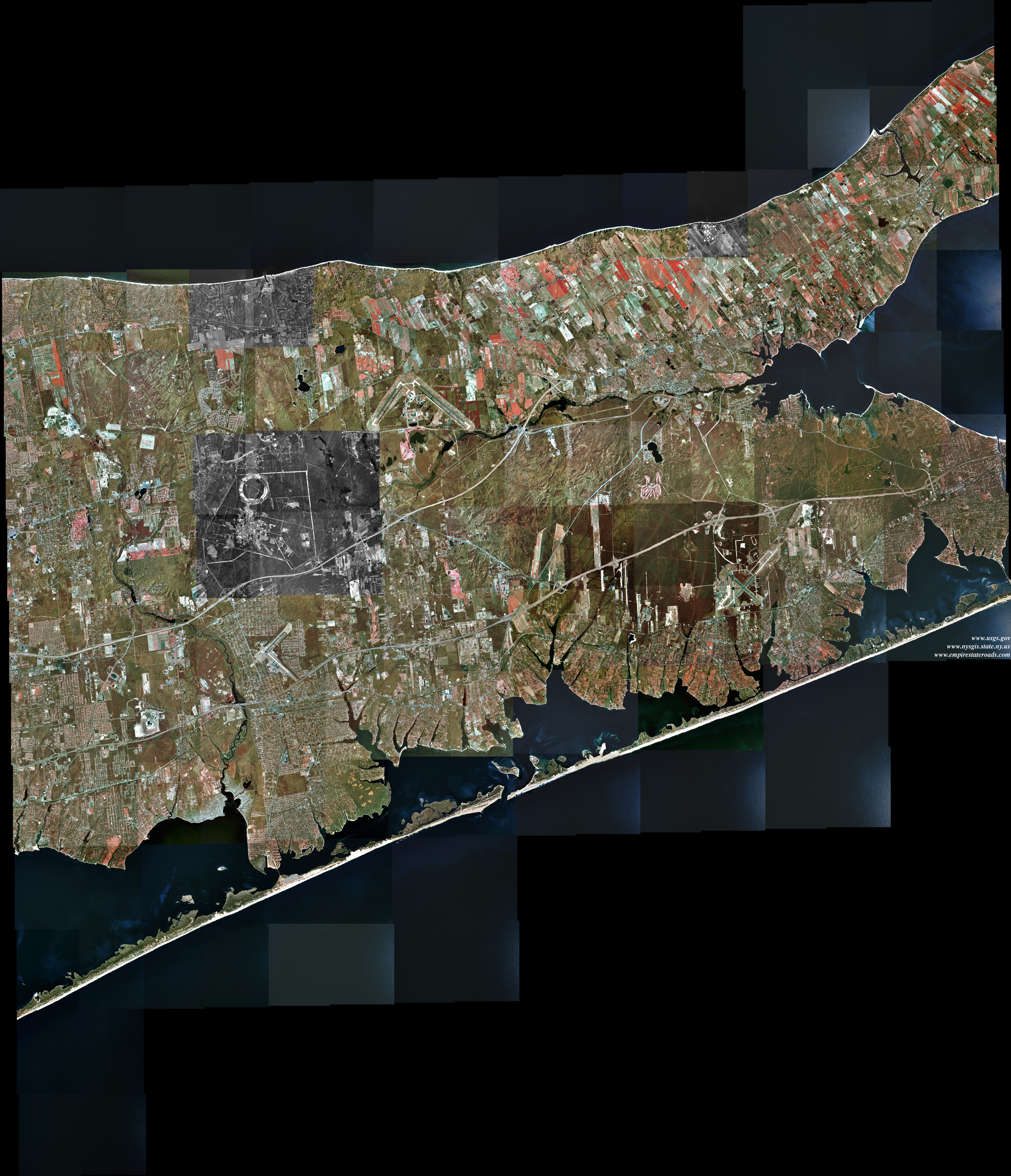
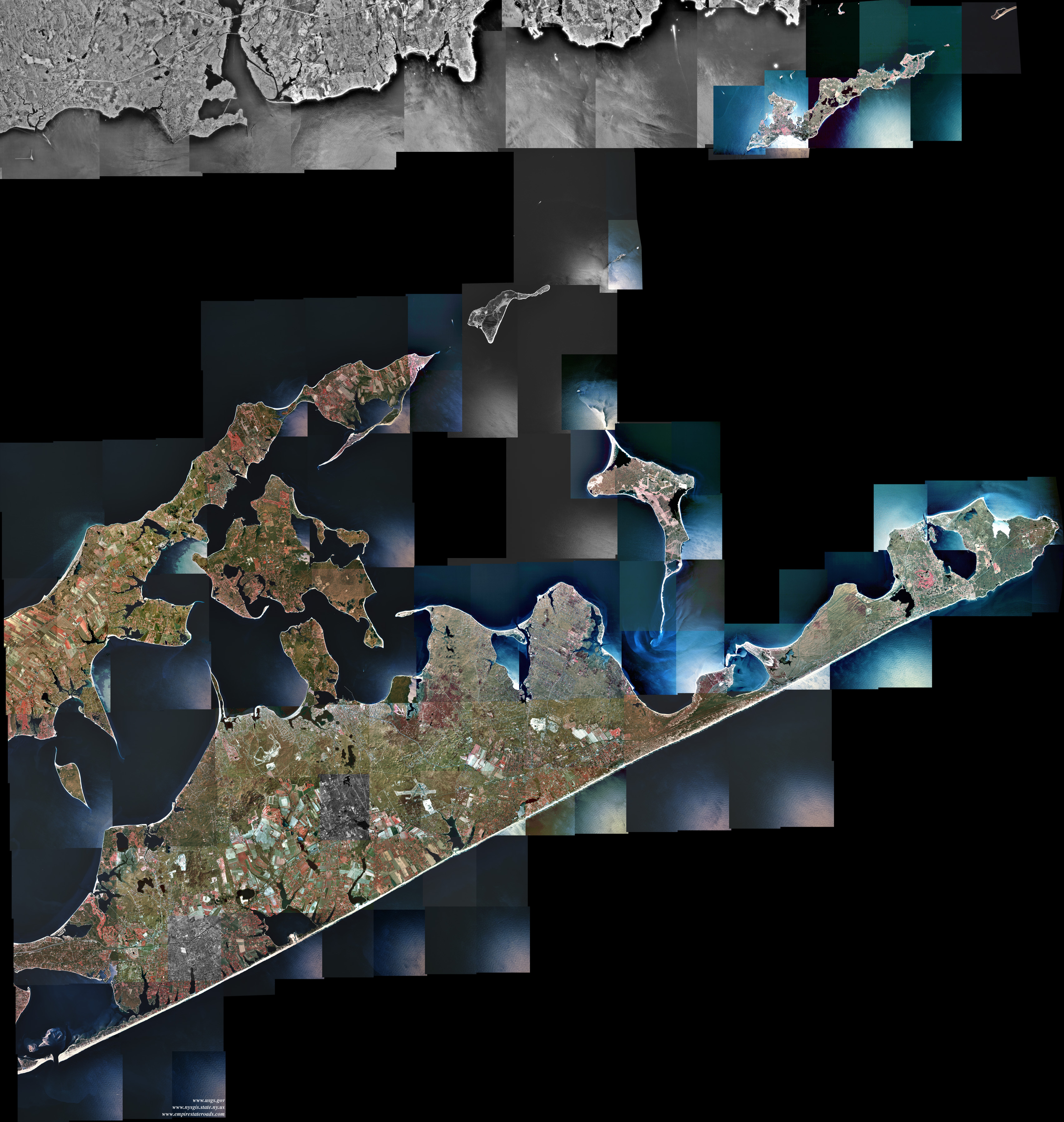
Suffolk County - East
(2.63 Mb)
Covers the Towns of East Hampton and Shelter Island,
and most of Southampton and Southold. Coverage extends from Cutchogue
to Orient Point, with Plum and Fishers Islands, and from Southampton to
Montauk Point. Compiled from East Hampton, Gardiners Island East,
Gardiners Island West, Greenport, Montauk Point, Mystic, Napeague
Beach, New London, Orient, Plum Island, Sag Harbor, Shinnecock Inlet,
Southampton, and Southold quadrangles. Coverage now extended to include
part of the Connecticut coast.
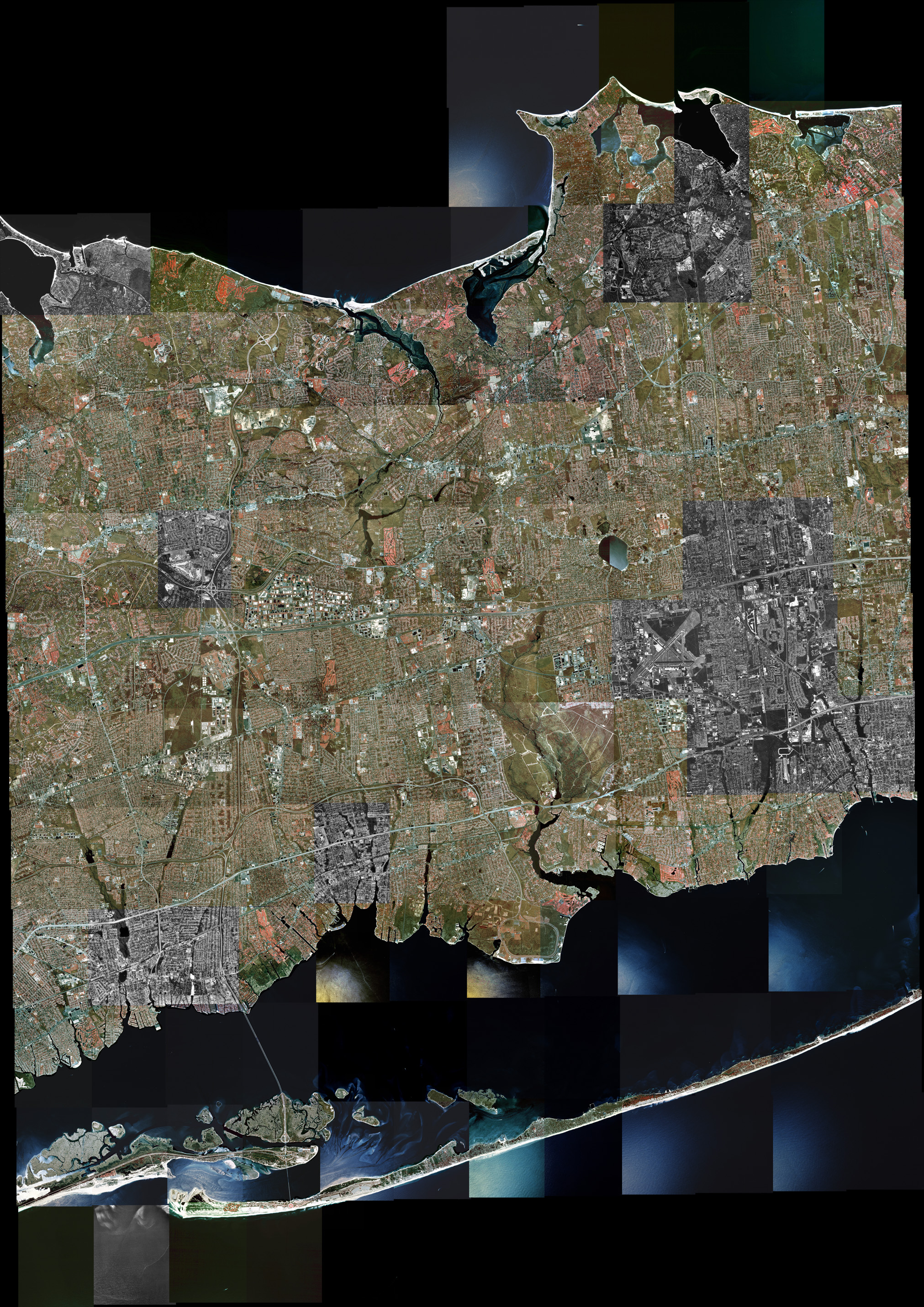
Suffolk County - West
(2.65 Mb)
Covers the Towns of Islip and Smithtown, with parts
of Babylon, Brookhaven and Huntington. Coverage extends from Northport
to Mount Sinai, Dix Hills to Coram, Deer Park to Farmingville, and
Babylon to Patchogue. Compiled from Bay Shore East, Bay Shore West,
Central Islip, Greenlawn, Northport, Patchogue, Port Jefferson, Saint
James and Sayville quadrangles.
Syracuse (2.62 Mb)
Covers most of the City of Syracuse and all of Onondaga Lake, as well
as Cicero Swamp and the western third of Oneida Lake. Includes Solvay,
Liverpool, East Syracuse, North Syracuse, Camillus, Baldwinsville,
Phoenix, and most of Fayetteville and Minoa. Compiled from
Baldwinsville, Brewerton, Camillus, Cicero, Syracuse East and Syracuse
West quadrangles.
Tupper Lake (2.84
Mb)
Covers Tupper Lake and the Village of the same name, along with
Piercefield and other neighboring areas. This mosaic is presented at
the same resolution (8 meters per pixel) as the quadrangle-based
images. Compiled from Piercefield and Tupper Lake quadrangles.
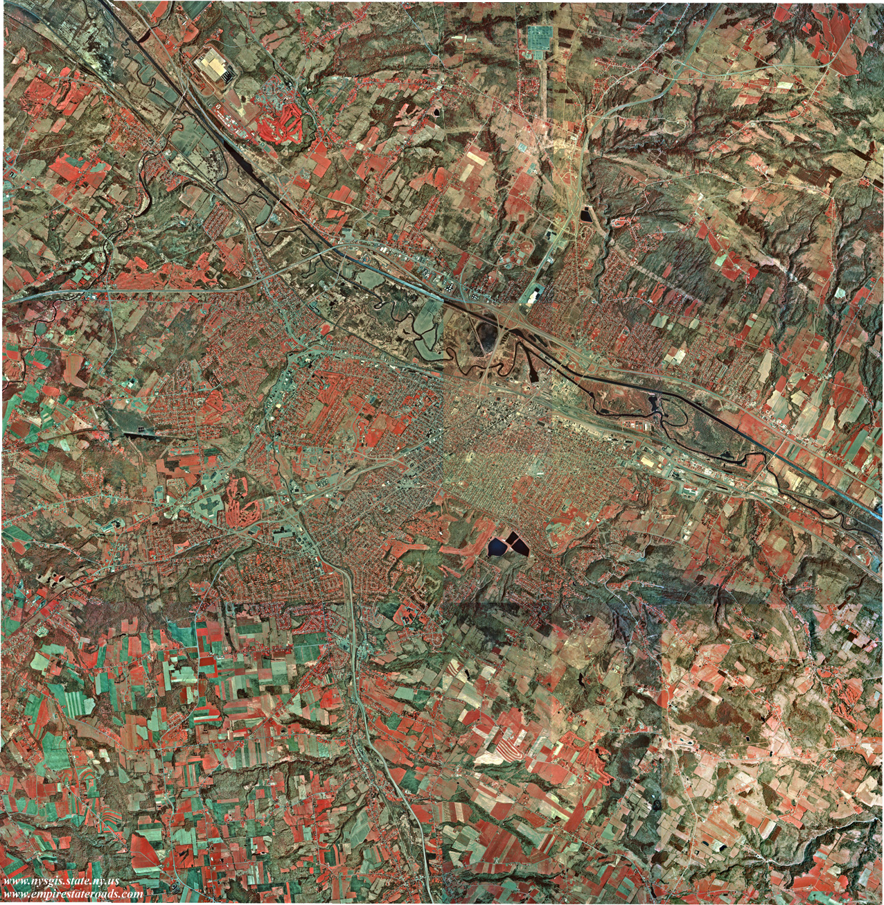
Utica (1.44 Mb)
Covers the City of Utica and its environs, including New Hartford,
Whitesboro, Yorkville, New York Mills, and Oriskany. Coverage also
extends to Sauquoit, southern Deerfield and West Schuyler. Compiled
from Utica East, Utica West and part of Oriskany and South Trenton
quadrangles.
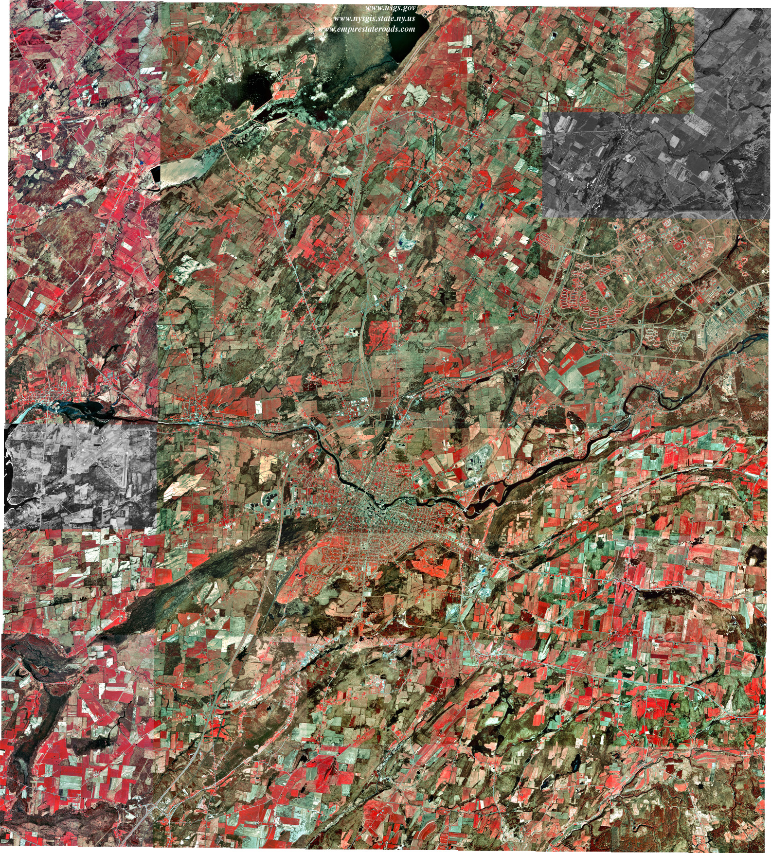
Watertown
(2.07 Mb)
Covers the City of Watertown and nearby communities of the lower Black
River. Also covers Evans Mills and a portion of the Fort Drum army
base. Compiled
from Black River, Brownville, Rutland Center, Watertown, and portions
of Dexter and Sackets Harbor
quadrangles.