![[ Nassau County Route Marker ]](nassaumark.png)
COUNTY ROADS
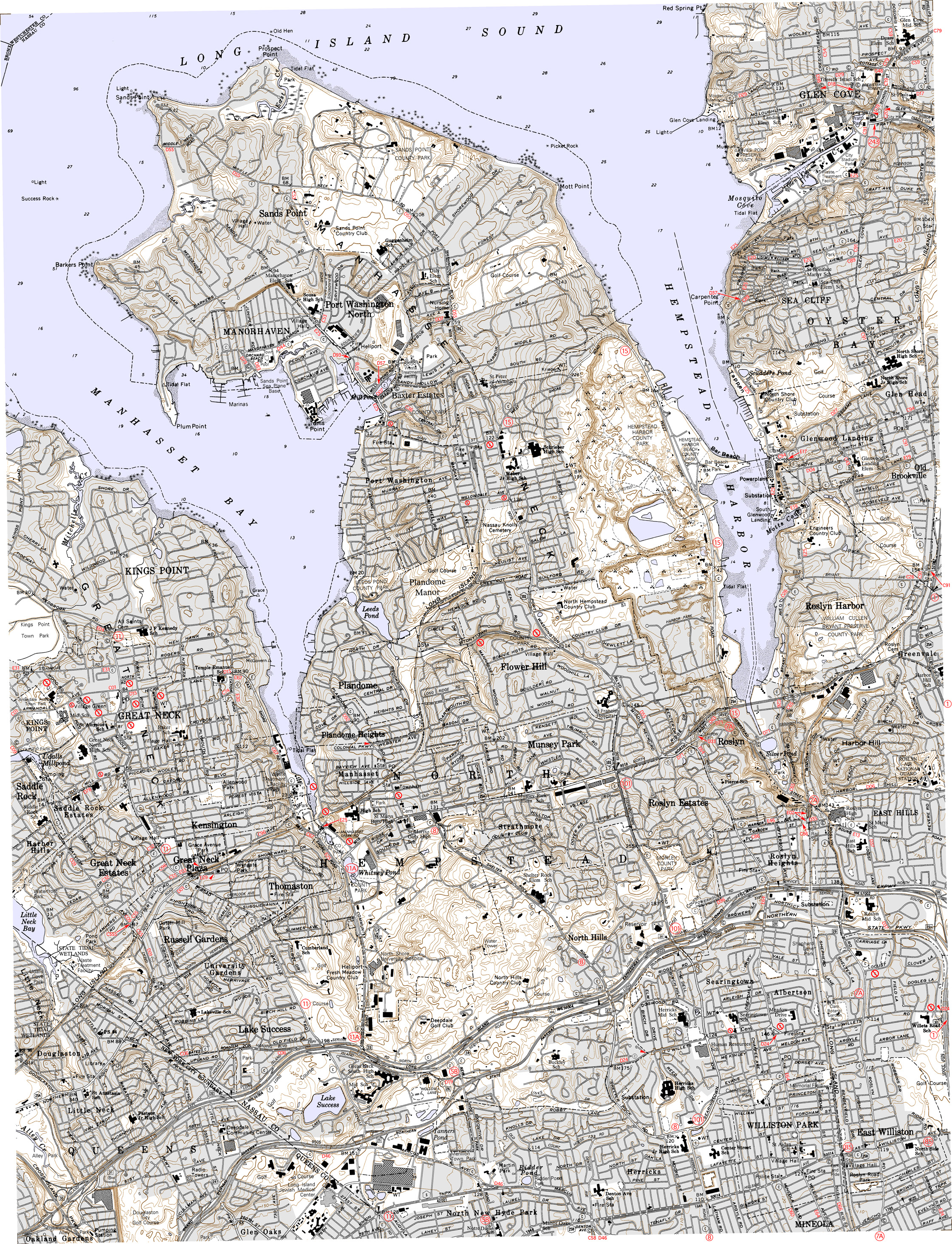
Nassau County Road Maps
These maps are derived from NYSDOT 7.5'
quadrangle
maps and have been annotated to show county road
designations in red. They are presented as high-quality JPEG files and
range in size from 1.4 to 5 MB. Please choose a map from the list
below, or use the index map.
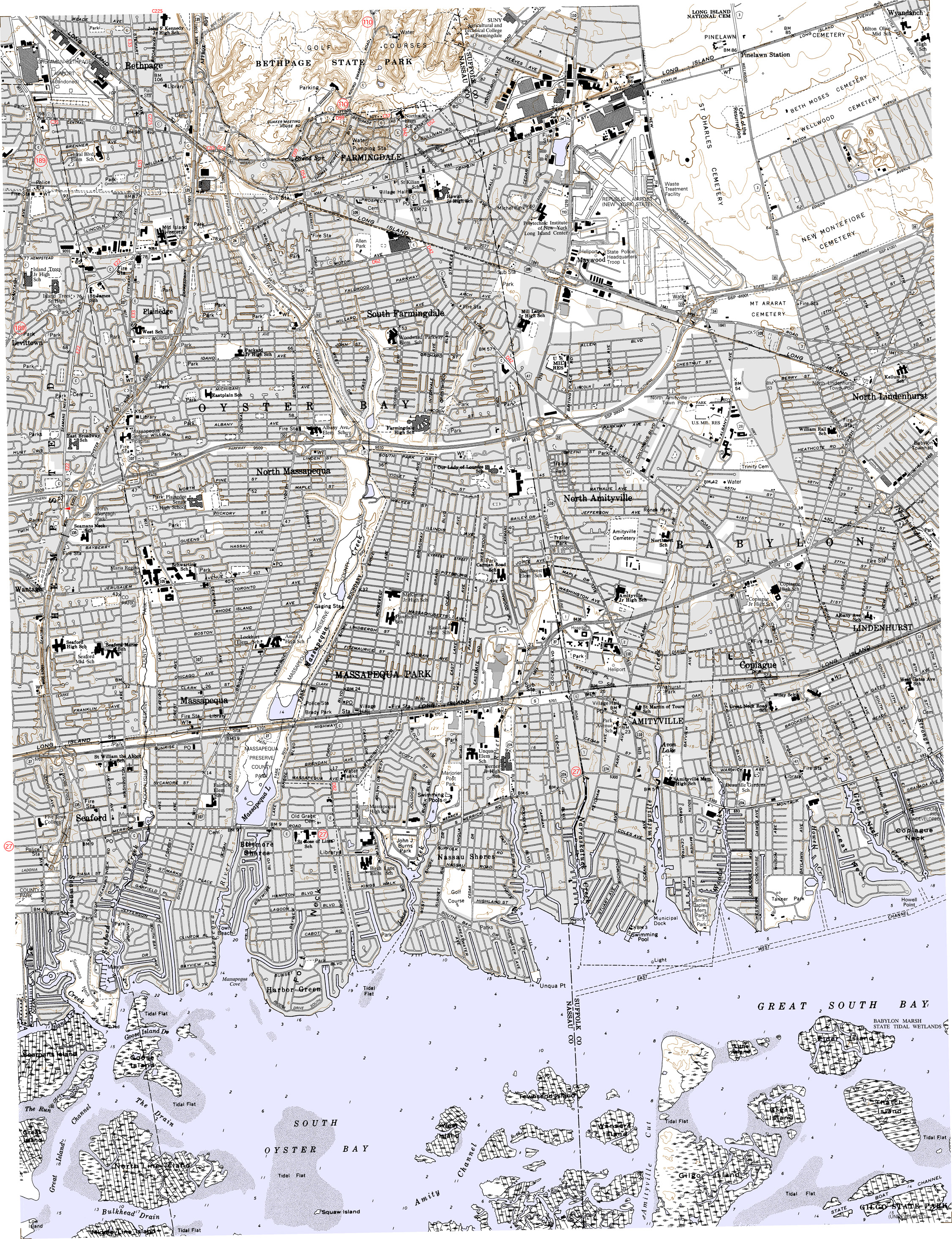
Amityville (3.9 MB)
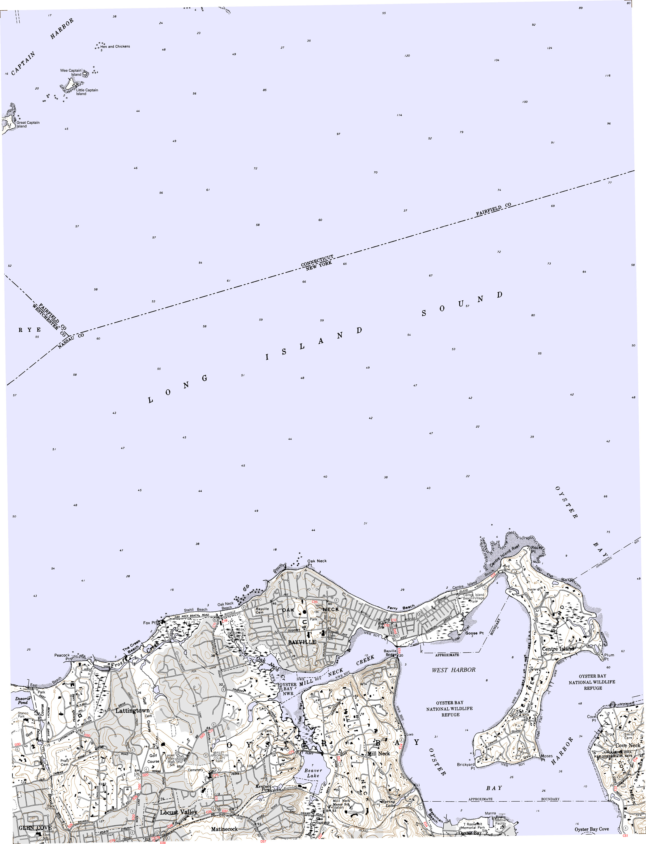
Bayville (1.4 MB)
Far Rockaway (1.4 MB)
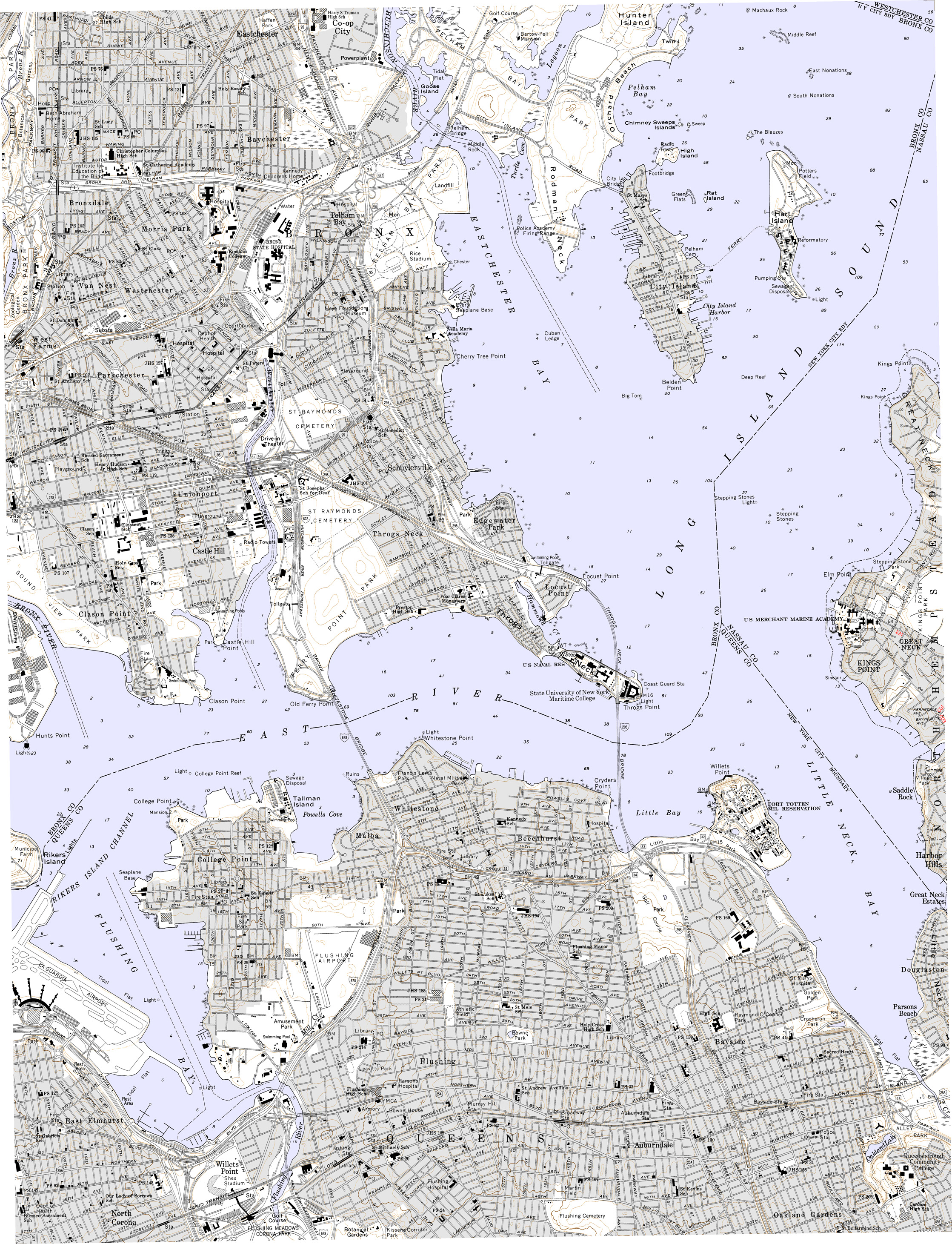
Flushing (3.2 MB)
Freeport (4.6 MB)
Hicksville (3.7 MB)
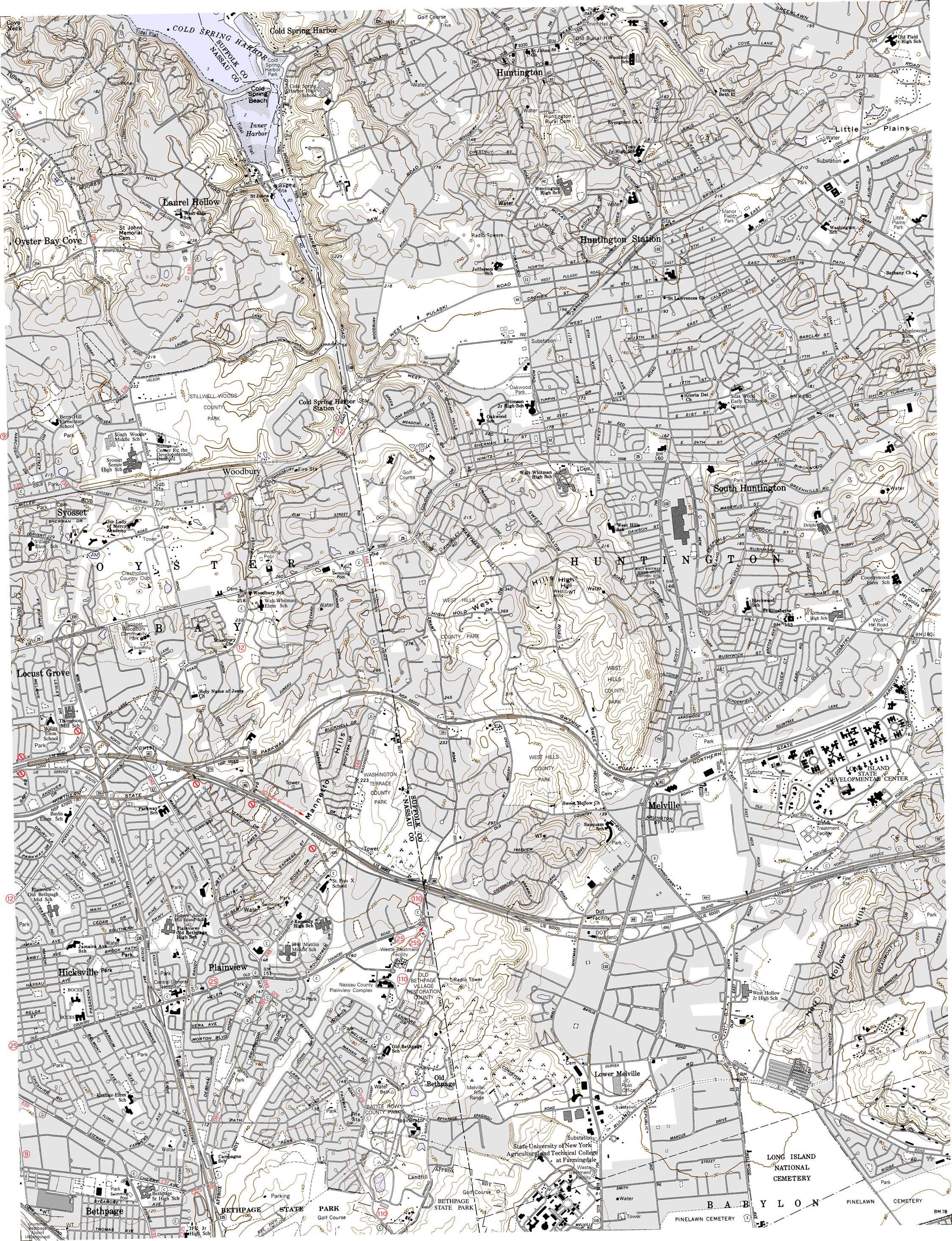
Huntington (4.1 MB)
Jamaica – no county roads in quadrangle
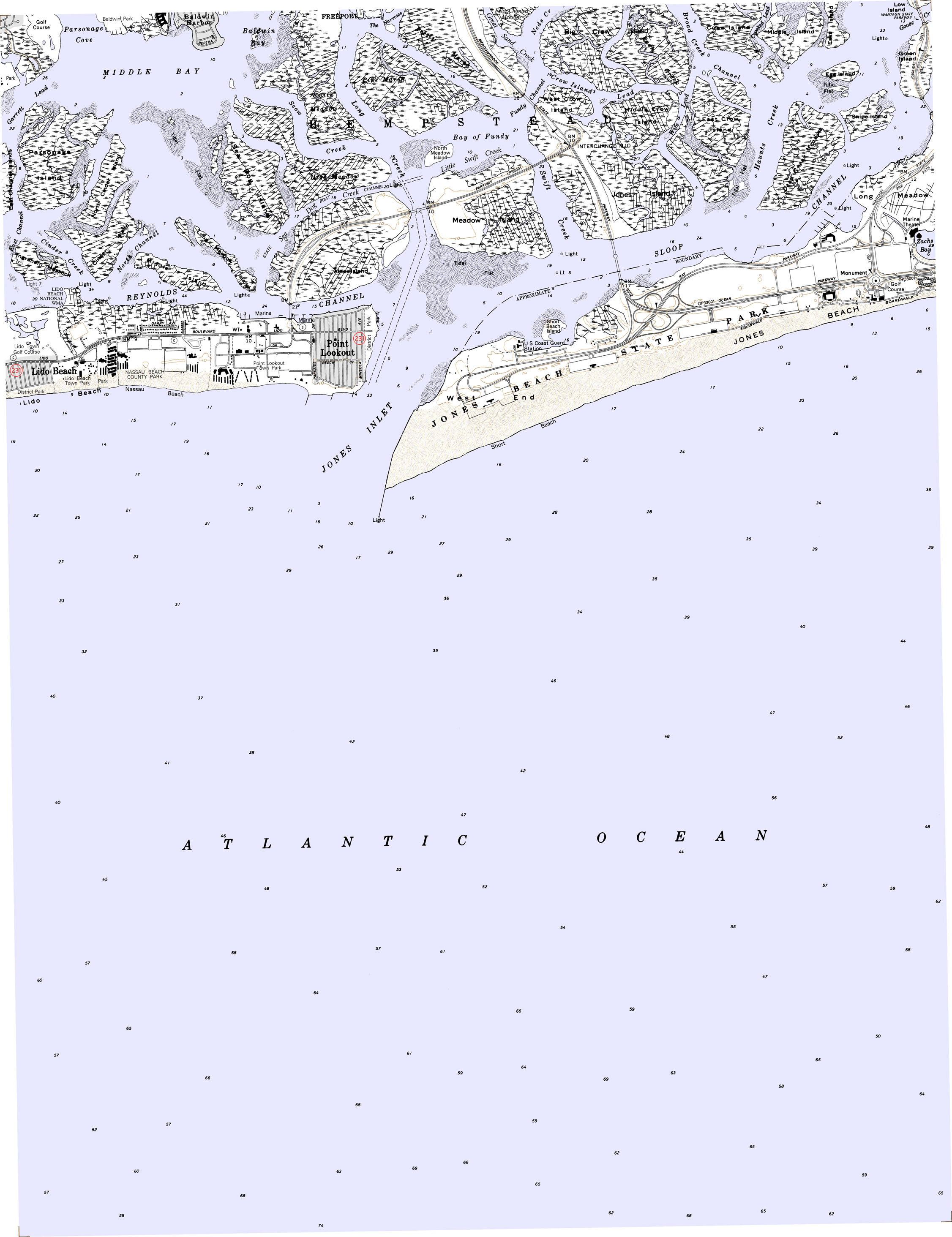
Jones Inlet (1.4 MB)
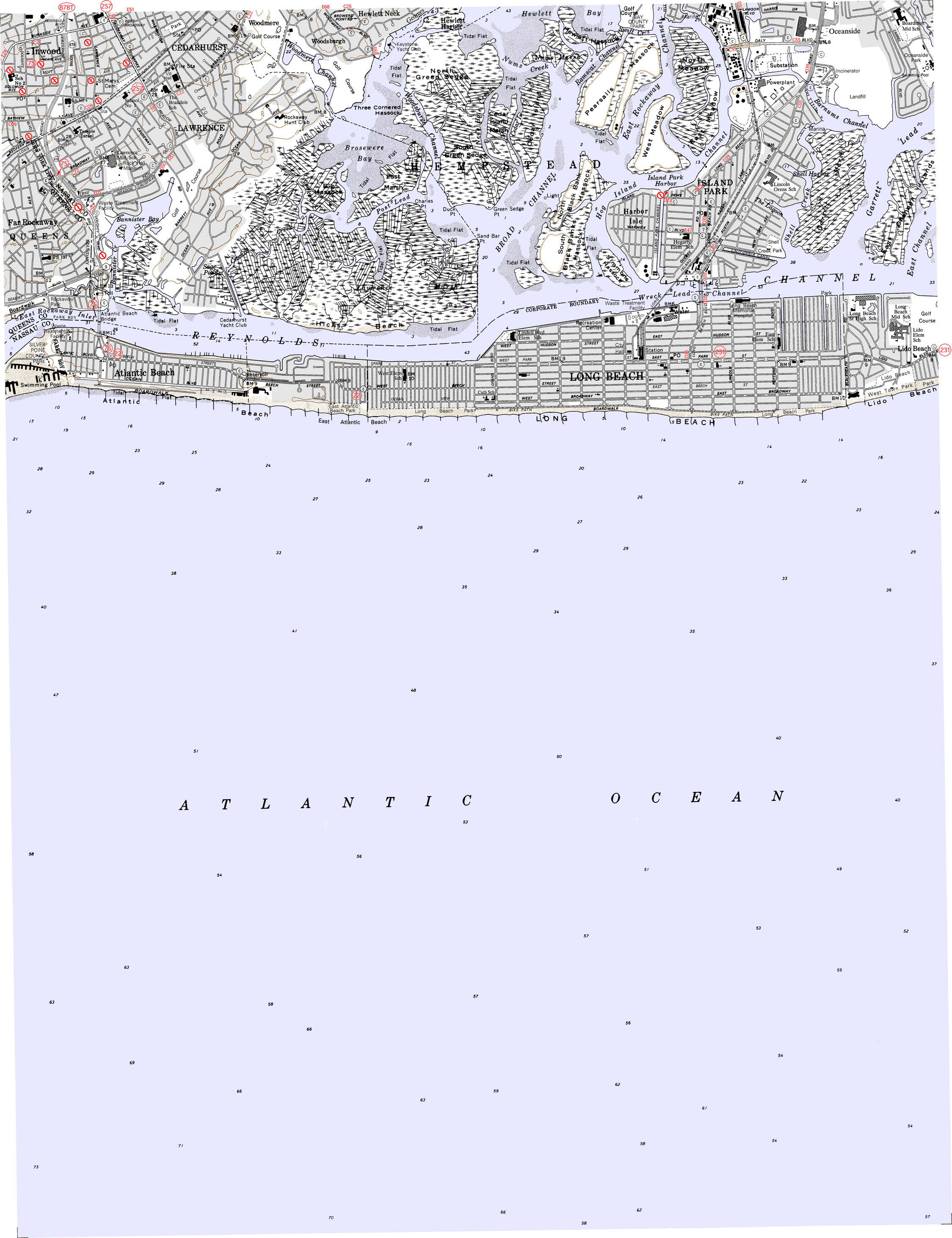
Lawrence (1.6 MB)
Lloyd Harbor – no county roads in quadrangle
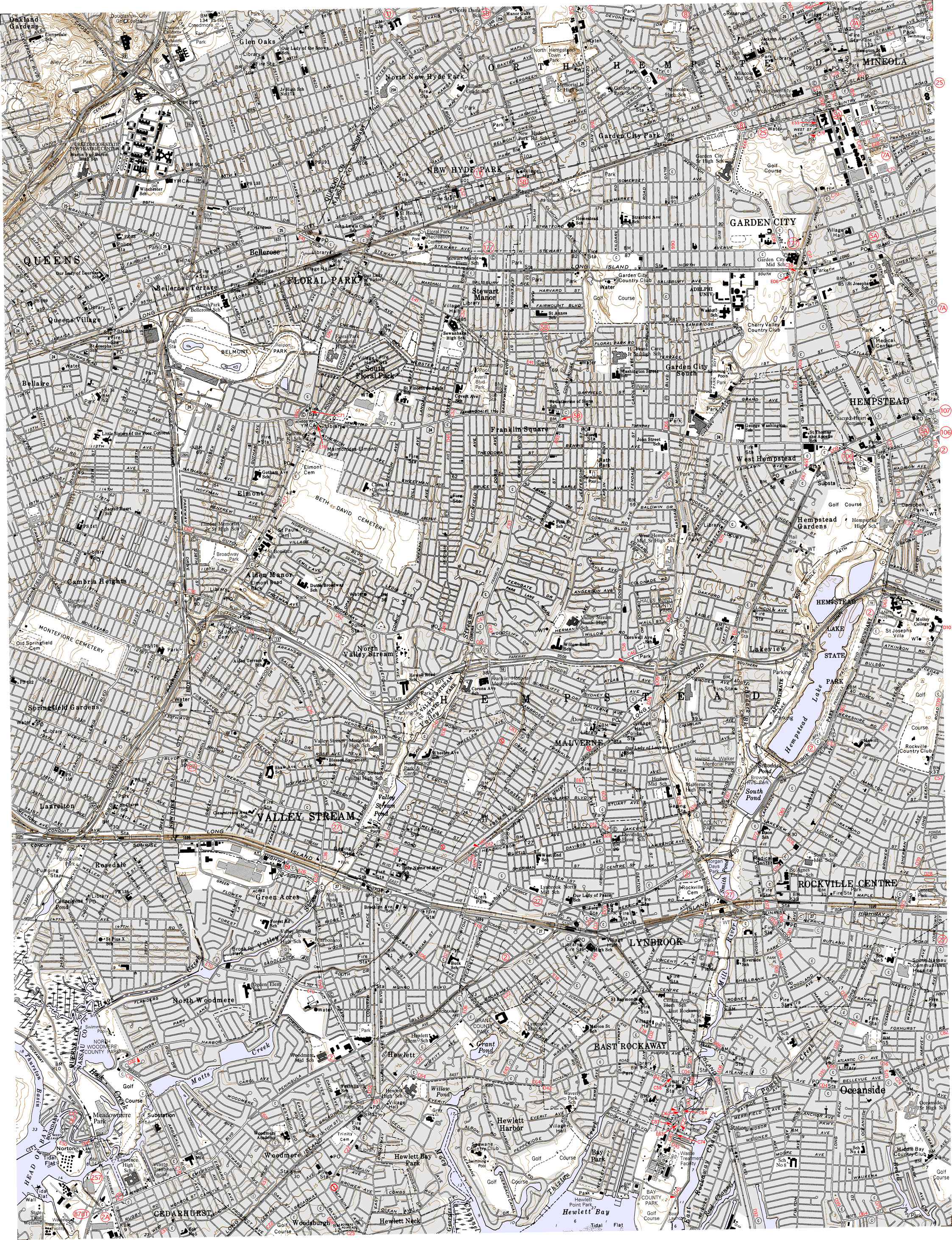
Lynbrook (5 MB)
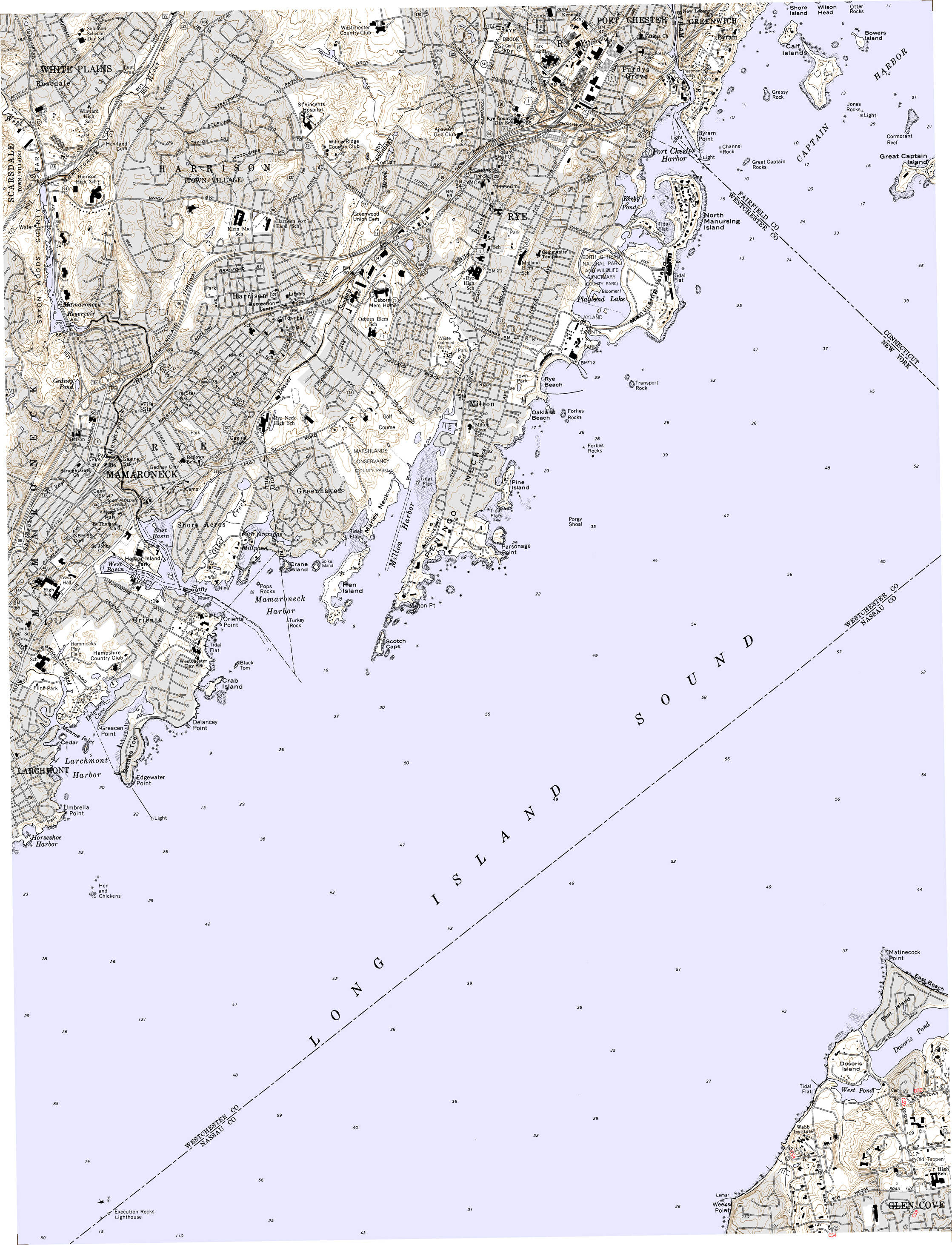
Mamaroneck (2.5 MB)
Sea Cliff (4.8 MB)
West Gilgo Beach – no county roads in quadrangle
All text and images created by
N. W. Perry unless otherwise credited.
This website ©1999-2011 by N. W. Perry.
Not affiliated with NYSDOT or any county highway department, nor any corporation or public agency.
This website ©1999-2011 by N. W. Perry.
Not affiliated with NYSDOT or any county highway department, nor any corporation or public agency.